




**
Overview
Santiago — officially Santiago de Chile — is the largest metropolis in Chile and one of the most influential cities in South America. Nestled in the Santiago Basin of the Central Valley, the city stretches from 500 m to 650 m above sea level, with newer neighborhoods spilling onto the foothills of the Andes. Its 7 million‑plus inhabitants (including the Greater Santiago conurbation) represent roughly one‑third of Chile’s total population, and the metropolitan area generates about 45 % of the country’s GDP. The urban landscape is a striking blend of sleek glass towers, historic colonial plazas, and sprawling residential districts framed by snow‑capped peaks.Geographically, Santiago enjoys a Mediterranean climate: warm, dry summers and cool, wet winters. The Mapocho River bisects the city, providing a natural spine around which the historic core and modern business districts have developed. A network of metro lines, commuter rails, and extensive bus corridors connects more than forty communes, making the city a model of Latin American urban mobility. Cultural life thrives in museums, theaters, and universities, while the surrounding vineyards of the Maipo Valley and the ski resorts of the Andes draw both locals and tourists.
History/Background
Founded on February 12 1541 by Spanish conquistador Pedro de Valdivia, Santiago was originally named Santiago del Nuevo Extremo in honor of Saint James, the patron saint of Spain. The settlement was strategically placed on a fertile plain near the Mapocho River, a decision that anchored its future as a commercial hub. Throughout the colonial era, Santiago served as the administrative center of the Captaincy General of Chile, but it remained relatively modest in size.The city’s fortunes surged after Chile’s independence in 1818, when Santiago became the nation’s capital. The 19th century brought railroads, the first university (the University of Chile, 1842), and a wave of European immigration that infused the city with French, Italian, and German architectural influences. The early 20th century saw rapid industrialization; the 1930s and 1940s marked the rise of a robust middle class and the expansion of public services.
A pivotal moment arrived in 1973, when a military coup led by General Augusto Pinochet toppled the democratically elected government. The ensuing dictatorship reshaped Santiago’s urban fabric through massive public‑housing projects and the construction of wide avenues (e.g., Avenida Libertador General Bernardo O’Higgins). After the return to democracy in 1990, the city entered a period of revitalization: historic neighborhoods were restored, the metro system was dramatically expanded, and Santiago emerged as a global financial center.
Key Information
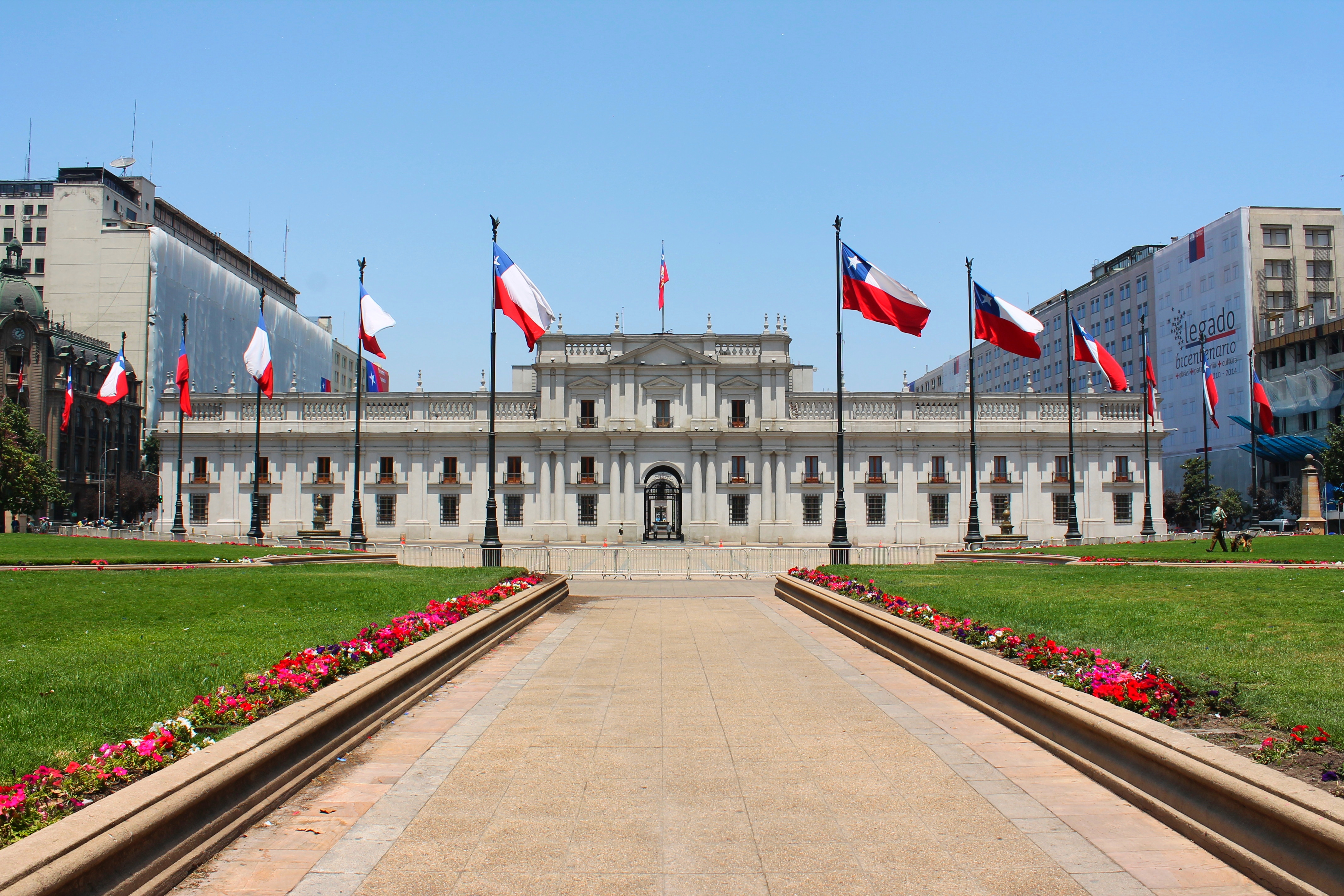
- Population (2023): ~7.2 million (metro area) - Area: 641 km² (city proper); 15,403 km² (metropolitan region) - Elevation: 500 – 650 m above sea level - GDP contribution: ~45 % of Chile’s national output - Major institutions: University of Chile, Pontifical Catholic University of Chile, Chilean Stock Exchange (BCS), Central Bank of Chile - Transport: 7‑line Metro de Santiago, extensive bus rapid transit (Transantiago), international airport (Arturo Merino Benítez) - Cultural landmarks: Plaza de Armas, Cerro San Cristóbal, Museo de la Memoria y los Derechos Humanos, La Moneda Palace, Bellavista arts district - Climate: Mediterranean (Csb), average annual precipitation ≈ 300 mm, summer highs ≈ 30 °C, winter lows ≈ 5 °CSignificance
Santiago’s importance extends far beyond its borders. Economically, it is the gateway for foreign investment into Chile’s mining, agriculture, and technology sectors, acting as a hub for multinational corporations and start‑ups alike. Politically, the city houses the nation’s highest offices, including the Presidential Palace (La Moneda), making it the epicenter of Chilean governance and diplomatic activity.Culturally, Santiago is a crucible where indigenous Mapuche heritage, Spanish colonial legacy, and contemporary Latin American creativity intersect. Its museums and public art projects confront the nation’s complex history, from pre‑colonial societies to the memory of the Pinochet era. The city’s vibrant culinary scene—featuring empanadas, pastel de choclo, and world‑class wines from nearby valleys—has positioned Santiago as a gastronomic destination.
Environmentally, Santiago faces challenges typical of rapidly growing megacities: air pollution, water scarcity, and seismic risk. Yet it also leads innovative solutions, such as the “Santiago Green Belt” project that expands urban parks, and a pioneering electric bus fleet that reduces carbon emissions. These initiatives make Santiago a case study in balancing development with sustainability in the 21st century.
INFOBOX:
- Name: Santiago de Chile
- Type: Capital city / Metropolitan region
- Date: Founded 1541 (city); designated capital 1818 (independence)
- Location: Central Valley, Santiago Basin, Chile (500‑650 m a.s.l.)
- Known For: Political capital, economic engine of Chile, cultural crossroads between Andes and Pacific
TAGS: Chile, Capital cities, South America, Urban geography, History, Economy, Culture, Tourism


