


Geography
Countries, cities, landmarks, maps and demographics · 329 articles
 Accra
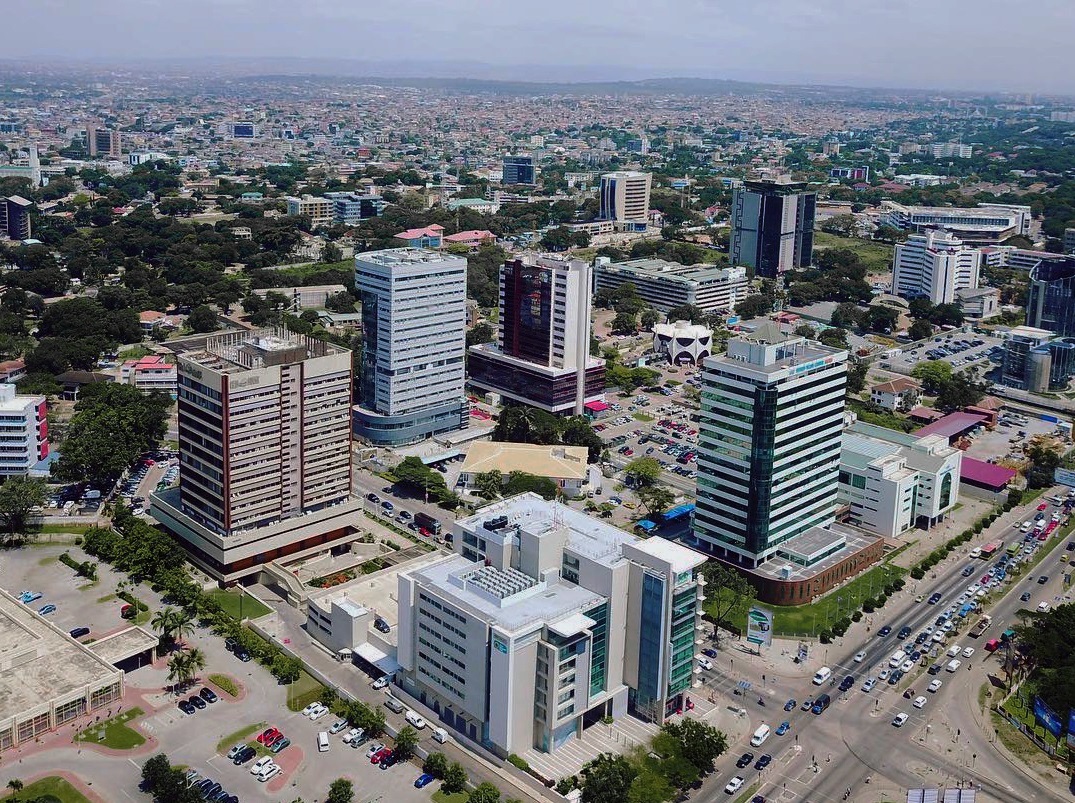
** Accra is Ghana’s bustling coastal capital, a vibrant metropolis where historic forts, modern skyscrapers and diverse cultures converge along the Gulf of Guinea.
**CONTENT:**
## Overview
Accra, the **capital and largest city of Ghana**, sits on the southern edge of West Africa, hugging the Gulf of Guinea. Though the official **Accra Metropolitan District** now covers just 20.4 km² and houses 284,124 residents (2021 census), the name “Accra” is commonly used to describe the broader urban agglomeration that stretches across the **Greater Accra Region**. This region spans 3,245 km² and is home to roughly **5.46 million people**, making it the nation’s most densely populated and economically dynamic area.
The city’s skyline is a mosaic of colonial-era structures, such as the **Kwame Nkrumah Mausoleum**, and gleaming high‑rise offices that host multinational corporations, embassies, and tech start‑ups. Streets pulse with the rhythm of market traders in **Makola Market**, street food vendors serving **kelewele** and **chinchinga**, and the occasional beat of highlife music spilling from open‑air venues. Accra’s coastal location gifts it a tropical climate, with warm temperatures year‑round and a brief rainy season that refreshes its mangrove‑lined beaches, notably **Labadi Beach** and **Kokrobite**.
Beyond its economic clout, Accra is a cultural crossroads. The city hosts the annual **Chale Wote Street Art Festival**, the **Accra International Film Festival**, and a thriving fashion scene that showcases Ghanaian designers on the global stage. Its universities, such as the **University of Ghana’s Accra campus**, attract scholars from across Africa, reinforcing the city’s reputation as an intellectual hub.
## History/Background
Accra’s origins trace back to a cluster of **Ga fishing villages** that dotted the coastline in the 15th century. The name “Accra” likely derives from the Akan word *Nkran*, meaning “ants,” a reference to the bustling activity of early settlers. In 1471, Portuguese explorers erected a fort at **São Jorge da Mina** (modern Elmina), establishing the first European foothold nearby; later, the Dutch and British built their own forts along the coast, including **Fort James** (now the **James Fort** museum) in Accra.
The city’s strategic harbor made it a focal point of the trans‑Atlantic slave trade, a dark chapter memorialized at the **Kumasi‑Accra Slave Route**. After the British formally declared the Gold Coast a colony in 1874, Accra grew as an administrative center. In 1957, when Ghana achieved independence under **Kwame Nkrumah**, Accra was designated the national capital, a status it retains today.
Rapid urbanization accelerated after independence, especially in the 1960s and 1970s, when rural migrants flocked to the city seeking employment. The original **Accra Metropolitan District** covered 199.4 km² and housed 1,782,150 people by the 2021 census. In 2008, the district was subdivided into 13 local government districts—12 municipal districts and the reduced **Accra Metropolitan District**—to improve governance and service delivery. The 20.4 km² core, now officially the **City of Accra**, was granted city status, distinguishing it from surrounding municipalities.
## Key Information
- **Population (2021):** 284,124 (Accra Metropolitan District); 5.46 million (Greater Accra Region).
- **Area:** 20.4 km² (city proper); 199.4 km² (pre‑2008 metropolitan area); 3,245 km² (Greater Accra Region).
- **Governance:** Managed by the **Accra Metropolitan Assembly (AMA)**; the wider capital area is overseen by 12 municipal assemblies.
- **Economy:** Hub for finance, telecommunications, tourism, and creative industries; home to the **Ghana Stock Exchange** and headquarters of major banks.
- **Transport:** Kotoka International Airport (the nation’s busiest gateway), a growing network of highways, and a nascent **Accra Light Rail** project.
- **Education & Culture:** Hosts the **University of Ghana**, **Accra Technical University**, and numerous cultural institutions like the **National Museum of Ghana**.
- **Landmarks:** **Independence Square**, **Jamestown Lighthouse**, **Makola Market**, **Osu Castle**, and the historic **Fort Christiansborg** (now the presidential palace).
## Significance
Accra’s importance extends far beyond its administrative role. Economically, it drives over **30 % of Ghana’s GDP**, acting as a magnet for foreign direct investment and a launchpad for West African startups. Its ports and airport make it a logistical gateway to the **ECOWAS** (Economic Community of West African States) market, linking landlocked neighbors to global trade routes.
Culturally, Accra is a living laboratory of African urbanism, where traditional **Ga** customs coexist with contemporary art movements. The city’s festivals and galleries have positioned it as a beacon of African creativity, influencing fashion, music, and film across the continent. Moreover, Accra’s diplomatic concentration—hosting over 70 embassies—underscores its role in regional politics and peacekeeping initiatives.
Socially, the city grapples with challenges typical of fast‑growing metropolises: housing shortages, traffic congestion, and environmental pressures on its coastal ecosystems. Yet, innovative urban planning efforts, such as the **Accra Sustainable City Initiative**, aim to transform these challenges into opportunities for green infrastructure, affordable housing, and resilient climate adaptation.
In sum, Accra is not merely Ghana’s capital; it is a dynamic engine of **economic growth**, a crucible of **cultural expression**, and a **strategic hub** shaping West Africa’s future.
**INFOBOX:**
- Name: Accra
- Type: Capital city / Metropolitan district
- Date: Established as capital of independent Ghana, 1957 (modern city status, 2008)
- Location: Southern coast of Ghana, Gulf of Guinea, West Africa
- Known For: Political capital, economic powerhouse, cultural hub, historic forts
**TAGS:** Ghana, Capital cities, West Africa, Urbanization, History, Culture, Economy, Tourism
Accra
** Accra is Ghana’s bustling coastal capital, a vibrant metropolis where historic forts, modern skyscrapers and diverse cultures converge along the Gulf of Guinea.
**CONTENT:**
## Overview
Accra, the **capital and largest city of Ghana**, sits on the southern edge of West Africa, hugging the Gulf of Guinea. Though the official **Accra Metropolitan District** now covers just 20.4 km² and houses 284,124 residents (2021 census), the name “Accra” is commonly used to describe the broader urban agglomeration that stretches across the **Greater Accra Region**. This region spans 3,245 km² and is home to roughly **5.46 million people**, making it the nation’s most densely populated and economically dynamic area.
The city’s skyline is a mosaic of colonial-era structures, such as the **Kwame Nkrumah Mausoleum**, and gleaming high‑rise offices that host multinational corporations, embassies, and tech start‑ups. Streets pulse with the rhythm of market traders in **Makola Market**, street food vendors serving **kelewele** and **chinchinga**, and the occasional beat of highlife music spilling from open‑air venues. Accra’s coastal location gifts it a tropical climate, with warm temperatures year‑round and a brief rainy season that refreshes its mangrove‑lined beaches, notably **Labadi Beach** and **Kokrobite**.
Beyond its economic clout, Accra is a cultural crossroads. The city hosts the annual **Chale Wote Street Art Festival**, the **Accra International Film Festival**, and a thriving fashion scene that showcases Ghanaian designers on the global stage. Its universities, such as the **University of Ghana’s Accra campus**, attract scholars from across Africa, reinforcing the city’s reputation as an intellectual hub.
## History/Background
Accra’s origins trace back to a cluster of **Ga fishing villages** that dotted the coastline in the 15th century. The name “Accra” likely derives from the Akan word *Nkran*, meaning “ants,” a reference to the bustling activity of early settlers. In 1471, Portuguese explorers erected a fort at **São Jorge da Mina** (modern Elmina), establishing the first European foothold nearby; later, the Dutch and British built their own forts along the coast, including **Fort James** (now the **James Fort** museum) in Accra.
The city’s strategic harbor made it a focal point of the trans‑Atlantic slave trade, a dark chapter memorialized at the **Kumasi‑Accra Slave Route**. After the British formally declared the Gold Coast a colony in 1874, Accra grew as an administrative center. In 1957, when Ghana achieved independence under **Kwame Nkrumah**, Accra was designated the national capital, a status it retains today.
Rapid urbanization accelerated after independence, especially in the 1960s and 1970s, when rural migrants flocked to the city seeking employment. The original **Accra Metropolitan District** covered 199.4 km² and housed 1,782,150 people by the 2021 census. In 2008, the district was subdivided into 13 local government districts—12 municipal districts and the reduced **Accra Metropolitan District**—to improve governance and service delivery. The 20.4 km² core, now officially the **City of Accra**, was granted city status, distinguishing it from surrounding municipalities.
## Key Information
- **Population (2021):** 284,124 (Accra Metropolitan District); 5.46 million (Greater Accra Region).
- **Area:** 20.4 km² (city proper); 199.4 km² (pre‑2008 metropolitan area); 3,245 km² (Greater Accra Region).
- **Governance:** Managed by the **Accra Metropolitan Assembly (AMA)**; the wider capital area is overseen by 12 municipal assemblies.
- **Economy:** Hub for finance, telecommunications, tourism, and creative industries; home to the **Ghana Stock Exchange** and headquarters of major banks.
- **Transport:** Kotoka International Airport (the nation’s busiest gateway), a growing network of highways, and a nascent **Accra Light Rail** project.
- **Education & Culture:** Hosts the **University of Ghana**, **Accra Technical University**, and numerous cultural institutions like the **National Museum of Ghana**.
- **Landmarks:** **Independence Square**, **Jamestown Lighthouse**, **Makola Market**, **Osu Castle**, and the historic **Fort Christiansborg** (now the presidential palace).
## Significance
Accra’s importance extends far beyond its administrative role. Economically, it drives over **30 % of Ghana’s GDP**, acting as a magnet for foreign direct investment and a launchpad for West African startups. Its ports and airport make it a logistical gateway to the **ECOWAS** (Economic Community of West African States) market, linking landlocked neighbors to global trade routes.
Culturally, Accra is a living laboratory of African urbanism, where traditional **Ga** customs coexist with contemporary art movements. The city’s festivals and galleries have positioned it as a beacon of African creativity, influencing fashion, music, and film across the continent. Moreover, Accra’s diplomatic concentration—hosting over 70 embassies—underscores its role in regional politics and peacekeeping initiatives.
Socially, the city grapples with challenges typical of fast‑growing metropolises: housing shortages, traffic congestion, and environmental pressures on its coastal ecosystems. Yet, innovative urban planning efforts, such as the **Accra Sustainable City Initiative**, aim to transform these challenges into opportunities for green infrastructure, affordable housing, and resilient climate adaptation.
In sum, Accra is not merely Ghana’s capital; it is a dynamic engine of **economic growth**, a crucible of **cultural expression**, and a **strategic hub** shaping West Africa’s future.
**INFOBOX:**
- Name: Accra
- Type: Capital city / Metropolitan district
- Date: Established as capital of independent Ghana, 1957 (modern city status, 2008)
- Location: Southern coast of Ghana, Gulf of Guinea, West Africa
- Known For: Political capital, economic powerhouse, cultural hub, historic forts
**TAGS:** Ghana, Capital cities, West Africa, Urbanization, History, Culture, Economy, Tourism
 Marco Wanderer
10
Marco Wanderer
10
 Acropolis Of Athens
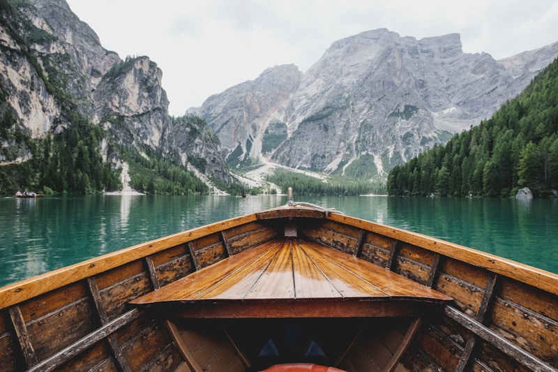
** The Acropolis of Athens is a towering limestone citadel crowned by iconic ancient monuments, epitomizing the artistic, religious, and political zenith of Classical Greece.
**CONTENT:**
## Overview
Perched 150 metres above the bustling streets of modern Athens, the **Acropolis** dominates the city’s skyline like a marble crown. This ancient citadel is a compact ensemble of temples, altars, and public buildings that together illustrate the aesthetic ideals and civic pride of the 5th century BC Athenian polis. The most famous structure, the **Parthenon**, gleams with sculptural narratives of gods and heroes, while the **Erechtheion**, **Propylaia**, and **Temple of Athena Nike** complete a harmonious architectural complex that has inspired countless replicas worldwide.
The Acropolis is not merely a collection of ruins; it is a living symbol of Western civilization. Visitors ascend the stone pathways to experience the interplay of light and shadow that ancient architects meticulously engineered, feeling the same awe that once moved Pericles, Sophocles, and the Athenian citizen‑soldier. Today, the site attracts over three million tourists annually, serving as a focal point for scholarly research, cultural festivals, and global dialogues on heritage preservation.
## History/Background
The hill that would become the Acropolis was sacred long before the Classical period, hosting Mycenaean shrines and Bronze‑Age cults dedicated to Athena Polias. In the early 6th century BC, the tyrant Peisistratus began the first major building program, erecting an altar and a primitive temple. After the Persian sack of Athens in 480 BC, the city embarked on an unprecedented reconstruction under the statesman **Pericles**. Between 447 and 432 BC, the **Golden Age of Athens** produced the Acropolis’s most celebrated monuments: the **Propylaia** (gateway), the **Parthenon** (dedicated to Athena), the **Erechtheion** (housing the ancient wooden cult statue of Athena and the sacred olive tree), and the **Temple of Athena Nike** (celebrating victory).
The Acropolis endured further transformations: Roman and Byzantine periods repurposed its structures for churches and fortifications; Ottoman occupiers used the Parthenon as a gunpowder store, leading to the catastrophic 1687 explosion. In the 19th century, after Greece’s independence, the newly formed Greek state launched systematic archaeological excavations and restoration efforts, a process that continues today under the aegis of UNESCO, which inscribed the site as a World Heritage Site in 1987.
## Key Information
- **Location:** Central Athens, Greece; coordinates 37°58′12″ N 23°43′09″ E.
- **Area:** Approximately 3 hectares (7.5 acres) of limestone plateau.
- **Construction Period:** Primarily 447–432 BC (Classical phase).
- **Architects:** Ictinus and Callicrates (Parthenon); Mnesicles (Propylaia); architects unknown for Erechtheion and Nike Temple.
- **Materials:** Pentelic marble for columns and cladding; limestone core; bronze for structural ties (now lost).
- **Population Impact:** The Acropolis served as a religious hub for the entire Athenian citizenry, influencing civic identity and democratic rituals such as the Panathenaic procession.
- **Preservation Status:** Ongoing “Anastylosis” restoration—reassembling original marble fragments with modern supports; digital 3‑D scanning projects map structural stress.
- **Cultural Legacy:** The Parthenon’s sculptural frieze inspired the neoclassical movement; the term “Acropolis” now denotes any fortified hilltop citadel worldwide.
## Significance
The Acropolis of Athens stands as a testament to the **human pursuit of beauty, order, and civic virtue**. Its architectural innovations—such as the subtle curvature of the Parthenon’s columns (entasis) and the precision of its optical refinements—redefined engineering possibilities and set standards for proportion that still guide architects today. Religiously, the site embodied the protective presence of **Athena**, the patron goddess of wisdom and war, reinforcing the ideological link between divine favor and democratic governance.
Politically, the Acropolis symbolized Athenian supremacy during the Delian League era, projecting power across the Aegean and beyond. Its destruction by the Persians and subsequent rebirth under Pericles became a narrative of resilience that resonated through Roman, Byzantine, and modern Greek histories. In contemporary discourse, the Acropolis is a focal point for debates on cultural restitution, as fragments like the **Elgin Marbles** remain in foreign museums, prompting international negotiations about heritage ownership.
Ultimately, the Acropolis is more than stone; it is a cultural compass that continues to guide humanity’s understanding of art, democracy, and the enduring dialogue between past and present.
**INFOBOX:**
- Name: Acropolis of Athens
- Type: Ancient citadel and UNESCO World Heritage Site
- Date: Primarily constructed 447–432 BC (Classical period)
- Location: Athens, Greece (central Attica)
- Known For: The Parthenon, Erechtheion, Propylaia, and Temple of Athena Nike; pinnacle of Classical Greek architecture
**TAGS:** ancient Greece, architecture, UNESCO, classical art, Athens tourism, cultural heritage, democracy, archaeology
Marco Wanderer
13
Acropolis Of Athens
** The Acropolis of Athens is a towering limestone citadel crowned by iconic ancient monuments, epitomizing the artistic, religious, and political zenith of Classical Greece.
**CONTENT:**
## Overview
Perched 150 metres above the bustling streets of modern Athens, the **Acropolis** dominates the city’s skyline like a marble crown. This ancient citadel is a compact ensemble of temples, altars, and public buildings that together illustrate the aesthetic ideals and civic pride of the 5th century BC Athenian polis. The most famous structure, the **Parthenon**, gleams with sculptural narratives of gods and heroes, while the **Erechtheion**, **Propylaia**, and **Temple of Athena Nike** complete a harmonious architectural complex that has inspired countless replicas worldwide.
The Acropolis is not merely a collection of ruins; it is a living symbol of Western civilization. Visitors ascend the stone pathways to experience the interplay of light and shadow that ancient architects meticulously engineered, feeling the same awe that once moved Pericles, Sophocles, and the Athenian citizen‑soldier. Today, the site attracts over three million tourists annually, serving as a focal point for scholarly research, cultural festivals, and global dialogues on heritage preservation.
## History/Background
The hill that would become the Acropolis was sacred long before the Classical period, hosting Mycenaean shrines and Bronze‑Age cults dedicated to Athena Polias. In the early 6th century BC, the tyrant Peisistratus began the first major building program, erecting an altar and a primitive temple. After the Persian sack of Athens in 480 BC, the city embarked on an unprecedented reconstruction under the statesman **Pericles**. Between 447 and 432 BC, the **Golden Age of Athens** produced the Acropolis’s most celebrated monuments: the **Propylaia** (gateway), the **Parthenon** (dedicated to Athena), the **Erechtheion** (housing the ancient wooden cult statue of Athena and the sacred olive tree), and the **Temple of Athena Nike** (celebrating victory).
The Acropolis endured further transformations: Roman and Byzantine periods repurposed its structures for churches and fortifications; Ottoman occupiers used the Parthenon as a gunpowder store, leading to the catastrophic 1687 explosion. In the 19th century, after Greece’s independence, the newly formed Greek state launched systematic archaeological excavations and restoration efforts, a process that continues today under the aegis of UNESCO, which inscribed the site as a World Heritage Site in 1987.
## Key Information
- **Location:** Central Athens, Greece; coordinates 37°58′12″ N 23°43′09″ E.
- **Area:** Approximately 3 hectares (7.5 acres) of limestone plateau.
- **Construction Period:** Primarily 447–432 BC (Classical phase).
- **Architects:** Ictinus and Callicrates (Parthenon); Mnesicles (Propylaia); architects unknown for Erechtheion and Nike Temple.
- **Materials:** Pentelic marble for columns and cladding; limestone core; bronze for structural ties (now lost).
- **Population Impact:** The Acropolis served as a religious hub for the entire Athenian citizenry, influencing civic identity and democratic rituals such as the Panathenaic procession.
- **Preservation Status:** Ongoing “Anastylosis” restoration—reassembling original marble fragments with modern supports; digital 3‑D scanning projects map structural stress.
- **Cultural Legacy:** The Parthenon’s sculptural frieze inspired the neoclassical movement; the term “Acropolis” now denotes any fortified hilltop citadel worldwide.
## Significance
The Acropolis of Athens stands as a testament to the **human pursuit of beauty, order, and civic virtue**. Its architectural innovations—such as the subtle curvature of the Parthenon’s columns (entasis) and the precision of its optical refinements—redefined engineering possibilities and set standards for proportion that still guide architects today. Religiously, the site embodied the protective presence of **Athena**, the patron goddess of wisdom and war, reinforcing the ideological link between divine favor and democratic governance.
Politically, the Acropolis symbolized Athenian supremacy during the Delian League era, projecting power across the Aegean and beyond. Its destruction by the Persians and subsequent rebirth under Pericles became a narrative of resilience that resonated through Roman, Byzantine, and modern Greek histories. In contemporary discourse, the Acropolis is a focal point for debates on cultural restitution, as fragments like the **Elgin Marbles** remain in foreign museums, prompting international negotiations about heritage ownership.
Ultimately, the Acropolis is more than stone; it is a cultural compass that continues to guide humanity’s understanding of art, democracy, and the enduring dialogue between past and present.
**INFOBOX:**
- Name: Acropolis of Athens
- Type: Ancient citadel and UNESCO World Heritage Site
- Date: Primarily constructed 447–432 BC (Classical period)
- Location: Athens, Greece (central Attica)
- Known For: The Parthenon, Erechtheion, Propylaia, and Temple of Athena Nike; pinnacle of Classical Greek architecture
**TAGS:** ancient Greece, architecture, UNESCO, classical art, Athens tourism, cultural heritage, democracy, archaeology
Marco Wanderer
13
 Afghanistan
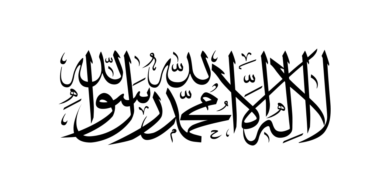
** Afghanistan, officially the Islamic Emirate of Afghanistan, is a rugged, land‑locked nation at the crossroads of Central and South Asia, known for its mountainous terrain, diverse cultures, and a tumultuous modern history.
**CONTENT:**
## Overview
Afghanistan occupies **652,864 km²** of rugged terrain, making it the 41st largest country in the world. The **Hindu Kush** mountain chain dominates the landscape, slicing the nation into a high‑altitude plateau in the east and a series of fertile plains in the north and southwest. This dramatic topography has shaped the lives of its peoples for millennia, fostering a mosaic of ethnic groups—primarily **Pashtuns**, **Tajiks**, **Hazaras**, and **Uzbeks**—each with distinct languages, customs, and histories.
The capital, **Kabul**, sits in a valley at 1,800 m above sea level and serves as the political, economic, and cultural hub. Despite its modest size, the city has been a crossroads for trade caravans traveling the ancient Silk Road, linking the Indian subcontinent with Central Asia and the Middle East. Afghanistan’s population estimates range from **35 million to 50 million**, reflecting both rapid growth and the challenges of census‑taking in a country marked by internal displacement and migration.
Bordering **Pakistan**, **Iran**, **Turkmenistan**, **Uzbekistan**, **Tajikistan**, and a narrow strip of **China’s** Xinjiang region, Afghanistan’s strategic location has made it a focal point for regional power dynamics. Its land‑locked status has spurred reliance on neighboring ports and corridors, influencing contemporary debates over trade routes such as the **Lapis Lazuli** corridor and the **China‑Pakistan Economic Corridor (CPEC)**.
## History/Background
Human settlement in Afghanistan dates back to the **Indus Valley Civilization** (c. 3300 BCE), with successive waves of **Achaemenid**, **Greek**, **Kushan**, and **Islamic** empires leaving indelible marks. The region became a center of Buddhist culture in the early centuries CE, evident in the spectacular **Bamiyan Buddhas** (now destroyed). The Arab conquest in the 7th century introduced Islam, which gradually became the dominant faith and cultural framework.
The modern Afghan state emerged in the 18th century under **Ahmad Shah Durrani**, who unified disparate tribal territories into the **Durrani Empire**, often regarded as the foundation of contemporary Afghanistan. The 19th century “Great Game” between **Britain** and **Russia** turned Afghanistan into a buffer state, leading to three Anglo‑Afghan wars (1839‑1842, 1878‑1880, 1919). Independence was formally recognized after the **Treaty of Rawalpindi** in 1919.
The 20th century saw a series of monarchic, republican, and socialist regimes, culminating in the Soviet invasion of 1979. A decade of guerrilla warfare gave way to civil war after Soviet withdrawal in 1989, and the rise of the **Taliban** in the mid‑1990s established an austere Islamic emirate. The **U.S.-led invasion** in 2001 toppled the Taliban regime, ushering in a fragile democratic experiment that lasted two decades before the Taliban’s return to power in August 2021, re‑establishing the **Islamic Emirate of Afghanistan**.
## Key Information
- **Official name:** Islamic Emirate of Afghanistan
- **Capital & largest city:** Kabul (population ~4.6 million)
- **Area:** 652,864 km² (252,072 sq mi)
- **Population:** 35–50 million (2023 estimate)
- **Languages:** Dari (Afghan Persian) and Pashto (both official); numerous regional languages.
- **Religion:** Predominantly Sunni Islam (≈ 85 %); Shia minority (≈ 15 %).
- **Economy:** Agriculture (wheat, fruits, opium poppy), mining (copper, lithium), and a modest services sector; GDP per capita remains among the world’s lowest.
- **Geography:** 75 % mountainous; key ranges include the Hindu Kush, Pamir, and Safed Koh. The **Amu Darya** river forms the northern border, while the **Helmand** basin sustains the arid south.
- **Cultural heritage:** UNESCO sites such as **Minaret of Jam**, **Bamiyan Valley**, and the historic city of **Herat** showcase a blend of Persian, Islamic, and Central Asian artistry.
- **Current political structure:** The Taliban’s **Supreme Leader** holds ultimate authority; a **Cabinet** appointed by the leader administers ministries, though international recognition remains limited.
## Significance
Afghanistan’s significance stems from its **geopolitical crossroads**, serving as a conduit for trade, ideas, and, regrettably, conflict. Its mountains have historically provided refuge for insurgent movements, influencing regional security dynamics from the Soviet era to the post‑9/11 world. The country’s **cultural tapestry**—from poetry of **Rumi** and **Khalil Gibran** to intricate carpet weaving—has enriched global heritage, while its strategic mineral reserves (notably the **Azerbaijan‑Afghan copper‑gold project**) hold potential to reshape its economic future if stability returns.
The **humanitarian challenges**—mass displacement, limited healthcare, and educational gaps—underscore the global community’s responsibility to support Afghan refugees and development initiatives. Moreover, Afghanistan’s experience illustrates the complexities of nation‑building in a terrain where tribal affiliations, external interventions, and ideological currents intersect. Its legacy continues to inform debates on sovereignty, counter‑terrorism, and the ethics of foreign involvement in fragile states.
**INFOBOX:**
- Name: Islamic Emirate of Afghanistan
- Type: Sovereign nation (land‑locked)
- Date: Established 2021 (current regime) – historic foundations 1747 (Durrani Empire)
- Location: Central‑South Asia, bordering Pakistan, Iran, Turkmenistan, Uzbekistan, Tajikistan, China
- Known For: Strategic crossroads, rugged Hindu Kush mountains, rich cultural heritage, ongoing political transformation
**TAGS:** Afghanistan, Central Asia, Islamic Emirate, Hindu Kush, Kabul, Taliban, Silk Road, Geopolitics
Marco Wanderer
12
Afghanistan
** Afghanistan, officially the Islamic Emirate of Afghanistan, is a rugged, land‑locked nation at the crossroads of Central and South Asia, known for its mountainous terrain, diverse cultures, and a tumultuous modern history.
**CONTENT:**
## Overview
Afghanistan occupies **652,864 km²** of rugged terrain, making it the 41st largest country in the world. The **Hindu Kush** mountain chain dominates the landscape, slicing the nation into a high‑altitude plateau in the east and a series of fertile plains in the north and southwest. This dramatic topography has shaped the lives of its peoples for millennia, fostering a mosaic of ethnic groups—primarily **Pashtuns**, **Tajiks**, **Hazaras**, and **Uzbeks**—each with distinct languages, customs, and histories.
The capital, **Kabul**, sits in a valley at 1,800 m above sea level and serves as the political, economic, and cultural hub. Despite its modest size, the city has been a crossroads for trade caravans traveling the ancient Silk Road, linking the Indian subcontinent with Central Asia and the Middle East. Afghanistan’s population estimates range from **35 million to 50 million**, reflecting both rapid growth and the challenges of census‑taking in a country marked by internal displacement and migration.
Bordering **Pakistan**, **Iran**, **Turkmenistan**, **Uzbekistan**, **Tajikistan**, and a narrow strip of **China’s** Xinjiang region, Afghanistan’s strategic location has made it a focal point for regional power dynamics. Its land‑locked status has spurred reliance on neighboring ports and corridors, influencing contemporary debates over trade routes such as the **Lapis Lazuli** corridor and the **China‑Pakistan Economic Corridor (CPEC)**.
## History/Background
Human settlement in Afghanistan dates back to the **Indus Valley Civilization** (c. 3300 BCE), with successive waves of **Achaemenid**, **Greek**, **Kushan**, and **Islamic** empires leaving indelible marks. The region became a center of Buddhist culture in the early centuries CE, evident in the spectacular **Bamiyan Buddhas** (now destroyed). The Arab conquest in the 7th century introduced Islam, which gradually became the dominant faith and cultural framework.
The modern Afghan state emerged in the 18th century under **Ahmad Shah Durrani**, who unified disparate tribal territories into the **Durrani Empire**, often regarded as the foundation of contemporary Afghanistan. The 19th century “Great Game” between **Britain** and **Russia** turned Afghanistan into a buffer state, leading to three Anglo‑Afghan wars (1839‑1842, 1878‑1880, 1919). Independence was formally recognized after the **Treaty of Rawalpindi** in 1919.
The 20th century saw a series of monarchic, republican, and socialist regimes, culminating in the Soviet invasion of 1979. A decade of guerrilla warfare gave way to civil war after Soviet withdrawal in 1989, and the rise of the **Taliban** in the mid‑1990s established an austere Islamic emirate. The **U.S.-led invasion** in 2001 toppled the Taliban regime, ushering in a fragile democratic experiment that lasted two decades before the Taliban’s return to power in August 2021, re‑establishing the **Islamic Emirate of Afghanistan**.
## Key Information
- **Official name:** Islamic Emirate of Afghanistan
- **Capital & largest city:** Kabul (population ~4.6 million)
- **Area:** 652,864 km² (252,072 sq mi)
- **Population:** 35–50 million (2023 estimate)
- **Languages:** Dari (Afghan Persian) and Pashto (both official); numerous regional languages.
- **Religion:** Predominantly Sunni Islam (≈ 85 %); Shia minority (≈ 15 %).
- **Economy:** Agriculture (wheat, fruits, opium poppy), mining (copper, lithium), and a modest services sector; GDP per capita remains among the world’s lowest.
- **Geography:** 75 % mountainous; key ranges include the Hindu Kush, Pamir, and Safed Koh. The **Amu Darya** river forms the northern border, while the **Helmand** basin sustains the arid south.
- **Cultural heritage:** UNESCO sites such as **Minaret of Jam**, **Bamiyan Valley**, and the historic city of **Herat** showcase a blend of Persian, Islamic, and Central Asian artistry.
- **Current political structure:** The Taliban’s **Supreme Leader** holds ultimate authority; a **Cabinet** appointed by the leader administers ministries, though international recognition remains limited.
## Significance
Afghanistan’s significance stems from its **geopolitical crossroads**, serving as a conduit for trade, ideas, and, regrettably, conflict. Its mountains have historically provided refuge for insurgent movements, influencing regional security dynamics from the Soviet era to the post‑9/11 world. The country’s **cultural tapestry**—from poetry of **Rumi** and **Khalil Gibran** to intricate carpet weaving—has enriched global heritage, while its strategic mineral reserves (notably the **Azerbaijan‑Afghan copper‑gold project**) hold potential to reshape its economic future if stability returns.
The **humanitarian challenges**—mass displacement, limited healthcare, and educational gaps—underscore the global community’s responsibility to support Afghan refugees and development initiatives. Moreover, Afghanistan’s experience illustrates the complexities of nation‑building in a terrain where tribal affiliations, external interventions, and ideological currents intersect. Its legacy continues to inform debates on sovereignty, counter‑terrorism, and the ethics of foreign involvement in fragile states.
**INFOBOX:**
- Name: Islamic Emirate of Afghanistan
- Type: Sovereign nation (land‑locked)
- Date: Established 2021 (current regime) – historic foundations 1747 (Durrani Empire)
- Location: Central‑South Asia, bordering Pakistan, Iran, Turkmenistan, Uzbekistan, Tajikistan, China
- Known For: Strategic crossroads, rugged Hindu Kush mountains, rich cultural heritage, ongoing political transformation
**TAGS:** Afghanistan, Central Asia, Islamic Emirate, Hindu Kush, Kabul, Taliban, Silk Road, Geopolitics
Marco Wanderer
12
 Ahmedabad
** Ahmedabad, the bustling heart of Gujarat, blends centuries‑old heritage with modern industry, making it India’s fifth‑largest city and a pivotal cultural and economic hub.
**CONTENT:**
## Overview
Ahmedabad, also spelled **Amdavad**, sits on the fertile banks of the **Sabarmati River** in western India. With a municipal population of **5,570,585** (2023 estimate) and an urban agglomeration of **8,854,444**, it ranks as the fifth‑most populous city in the nation and the seventh‑largest metro area. The city’s skyline is a striking juxtaposition of glittering glass towers, historic pol pol houses, and the iconic **Sabarmati Ashram**, the former residence of Mahatma Gandhi. Only 25 km (16 mi) to the north lies **Gandhinagar**, Gujarat’s capital, often referred to as Ahmedabad’s “twin city,” linked by a network of highways and a rapid‑transit system that underscores the region’s integrated growth.
Economically, Ahmedabad is a powerhouse of textiles, chemicals, pharmaceuticals, and information technology. The **Gujarat International Finance Tec-City (GIFT City)** on its outskirts marks the city’s ambition to become a global financial hub. Culturally, the city thrives on its vibrant festivals—**Uttarayan** (kite festival), **Navratri** dances, and the **International Kite Festival**—which draw visitors from across the globe. Its culinary scene, famed for **dhokla**, **khandvi**, and **Gujarati thali**, offers a sensory tour of the state’s vegetarian palate.
## History/Background
Founded in **1411** by Sultan **Ahmed Shah I**, the city was named after its founder and quickly grew into a fortified capital of the **Ahmedabad Sultanate**. The original city walls, still visible in parts of the old town, enclosed a bustling market where merchants from Persia, Arabia, and Central Asia exchanged silk, spices, and precious stones. In the 18th century, the **Maratha** and later the **British** took control, each leaving architectural imprints—from the **Jama Masjid** to the **British‑era railway station**.
The 20th century transformed Ahmedabad into a crucible of India’s independence movement. **Mahatma Gandhi** established the **Sabarmati Ashram** in 1915, turning the city into a strategic base for the **Salt March** (1930) and numerous civil‑disobedience campaigns. Post‑independence, the city’s textile mills earned it the nickname “**Manchester of India**,” fueling rapid urbanization and attracting a diverse workforce. In 1995, Ahmedabad was declared a **World Heritage City** by UNESCO for its unique blend of historic urban fabric and modern development.
## Key Information
- **Population (2023):** 5,570,585 (city), 8,854,444 (metro)
- **Area:** 464 km² (city proper)
- **Administrative Role:** Headquarters of Ahmedabad district; seat of the **Gujarat High Court**
- **Economic Highlights:** Textile hub, pharmaceutical clusters, GIFT City (financial services), Infosys and Tata Consultancy Services campuses
- **Transport:** Sardar Vallabhbhai Patel International Airport, Ahmedabad Metro (Phase 1 operational), extensive bus rapid‑transit (BRTS) network
- **Education:** Home to **Indian Institute of Management Ahmedabad (IIMA)**, **National Institute of Design (NID)**, and **Ahmedabad University**
- **Cultural Landmarks:** **Sabarmati Ashram**, **Adalaj Stepwell**, **Jama Masjid**, **Sidi Saiyyed Mosque** (famous “Tree of Life” latticework), **Calico Museum of Textiles**
- **Climate:** Semi‑arid, hot summers (up to 45 °C) and mild winters; monsoon rains from June to September.
## Significance
Ahmedabad’s importance transcends its size. Historically, it was a crucible of anti‑colonial activism, providing Gandhi a platform that resonated worldwide. Economically, the city’s textile legacy laid the groundwork for India’s broader industrialization, while contemporary ventures like GIFT City signal a shift toward knowledge‑based services and global finance. Culturally, Ahmedabad preserves a mosaic of Hindu, Muslim, Jain, and Parsi heritage, evident in its architecture, festivals, and culinary traditions, making it a living laboratory for scholars of urban pluralism. Moreover, its commitment to sustainable urban planning—evident in the **Sabarmati Riverfront Development Project** and extensive green belts—offers a model for other rapidly expanding Indian metros.
**INFOBOX:**
- Name: Ahmedabad (Amdavad)
- Type: Metropolitan City / Cultural‑Economic Hub
- Date: Founded 1411 (modern municipal corporation established 1950)
- Location: Gujarat, India; on the Sabarmati River, 25 km south of Gandhinagar
- Known For: Textile industry, Sabarmati Ashram, GIFT City, vibrant festivals, UNESCO World Heritage City status
**TAGS:** Ahmedabad, Gujarat, Indian cities, Mahatma Gandhi, Sabarmati River, textile industry, GIFT City, UNESCO heritage.
Marco Wanderer
20
Ahmedabad
** Ahmedabad, the bustling heart of Gujarat, blends centuries‑old heritage with modern industry, making it India’s fifth‑largest city and a pivotal cultural and economic hub.
**CONTENT:**
## Overview
Ahmedabad, also spelled **Amdavad**, sits on the fertile banks of the **Sabarmati River** in western India. With a municipal population of **5,570,585** (2023 estimate) and an urban agglomeration of **8,854,444**, it ranks as the fifth‑most populous city in the nation and the seventh‑largest metro area. The city’s skyline is a striking juxtaposition of glittering glass towers, historic pol pol houses, and the iconic **Sabarmati Ashram**, the former residence of Mahatma Gandhi. Only 25 km (16 mi) to the north lies **Gandhinagar**, Gujarat’s capital, often referred to as Ahmedabad’s “twin city,” linked by a network of highways and a rapid‑transit system that underscores the region’s integrated growth.
Economically, Ahmedabad is a powerhouse of textiles, chemicals, pharmaceuticals, and information technology. The **Gujarat International Finance Tec-City (GIFT City)** on its outskirts marks the city’s ambition to become a global financial hub. Culturally, the city thrives on its vibrant festivals—**Uttarayan** (kite festival), **Navratri** dances, and the **International Kite Festival**—which draw visitors from across the globe. Its culinary scene, famed for **dhokla**, **khandvi**, and **Gujarati thali**, offers a sensory tour of the state’s vegetarian palate.
## History/Background
Founded in **1411** by Sultan **Ahmed Shah I**, the city was named after its founder and quickly grew into a fortified capital of the **Ahmedabad Sultanate**. The original city walls, still visible in parts of the old town, enclosed a bustling market where merchants from Persia, Arabia, and Central Asia exchanged silk, spices, and precious stones. In the 18th century, the **Maratha** and later the **British** took control, each leaving architectural imprints—from the **Jama Masjid** to the **British‑era railway station**.
The 20th century transformed Ahmedabad into a crucible of India’s independence movement. **Mahatma Gandhi** established the **Sabarmati Ashram** in 1915, turning the city into a strategic base for the **Salt March** (1930) and numerous civil‑disobedience campaigns. Post‑independence, the city’s textile mills earned it the nickname “**Manchester of India**,” fueling rapid urbanization and attracting a diverse workforce. In 1995, Ahmedabad was declared a **World Heritage City** by UNESCO for its unique blend of historic urban fabric and modern development.
## Key Information
- **Population (2023):** 5,570,585 (city), 8,854,444 (metro)
- **Area:** 464 km² (city proper)
- **Administrative Role:** Headquarters of Ahmedabad district; seat of the **Gujarat High Court**
- **Economic Highlights:** Textile hub, pharmaceutical clusters, GIFT City (financial services), Infosys and Tata Consultancy Services campuses
- **Transport:** Sardar Vallabhbhai Patel International Airport, Ahmedabad Metro (Phase 1 operational), extensive bus rapid‑transit (BRTS) network
- **Education:** Home to **Indian Institute of Management Ahmedabad (IIMA)**, **National Institute of Design (NID)**, and **Ahmedabad University**
- **Cultural Landmarks:** **Sabarmati Ashram**, **Adalaj Stepwell**, **Jama Masjid**, **Sidi Saiyyed Mosque** (famous “Tree of Life” latticework), **Calico Museum of Textiles**
- **Climate:** Semi‑arid, hot summers (up to 45 °C) and mild winters; monsoon rains from June to September.
## Significance
Ahmedabad’s importance transcends its size. Historically, it was a crucible of anti‑colonial activism, providing Gandhi a platform that resonated worldwide. Economically, the city’s textile legacy laid the groundwork for India’s broader industrialization, while contemporary ventures like GIFT City signal a shift toward knowledge‑based services and global finance. Culturally, Ahmedabad preserves a mosaic of Hindu, Muslim, Jain, and Parsi heritage, evident in its architecture, festivals, and culinary traditions, making it a living laboratory for scholars of urban pluralism. Moreover, its commitment to sustainable urban planning—evident in the **Sabarmati Riverfront Development Project** and extensive green belts—offers a model for other rapidly expanding Indian metros.
**INFOBOX:**
- Name: Ahmedabad (Amdavad)
- Type: Metropolitan City / Cultural‑Economic Hub
- Date: Founded 1411 (modern municipal corporation established 1950)
- Location: Gujarat, India; on the Sabarmati River, 25 km south of Gandhinagar
- Known For: Textile industry, Sabarmati Ashram, GIFT City, vibrant festivals, UNESCO World Heritage City status
**TAGS:** Ahmedabad, Gujarat, Indian cities, Mahatma Gandhi, Sabarmati River, textile industry, GIFT City, UNESCO heritage.
Marco Wanderer
20
 Algiers
 is the vibrant capital city of Algeria, situated on the Mediterranean coast, boasting a rich history, diverse culture, and stunning natural surroundings.
## Overview
Algiers, the capital of Algeria, is a captivating metropolis that seamlessly blends **Ottoman**, **French**, and **Arab** influences, creating a unique cultural identity. Located on the Mediterranean Sea, Algiers is nestled between the majestic **Mitidja Plain** and the towering **Atlas Mountains**. The city's strategic position has made it a significant hub for trade, commerce, and cultural exchange throughout history. With a population of approximately 4.325 million people in 2025, Algiers is the largest city in Algeria, the third-largest on the Mediterranean, the sixth-largest in the Arab world, and the 29th-largest in Africa.
Algiers is a city of contrasts, where ancient architecture and modern skyscrapers coexist in harmony. The city's historic center, a UNESCO World Heritage Site, features a maze of narrow streets, bustling markets, and ornate mosques, while the modern city boasts sleek skyscrapers, trendy cafes, and vibrant nightlife. The city's diverse population is reflected in its cuisine, which combines traditional Algerian dishes with French and Mediterranean flavors.
## History/Background
Algiers has a rich and complex history that spans over 2,000 years. The city was founded by the Phoenicians in the 5th century BCE, and later became a major center of trade and commerce under the Romans. In the 16th century, Algiers was conquered by the Ottoman Empire, which brought a new wave of cultural and architectural influences to the city. The Ottomans built many of the city's iconic landmarks, including the **Casbah**, a walled medieval city that is now a UNESCO World Heritage Site.
In 1830, Algiers was occupied by the French, who ruled the city for over a century. During this period, the city underwent significant modernization and urbanization, with the construction of new infrastructure, buildings, and institutions. The French also introduced their language, culture, and architecture to the city, which had a lasting impact on Algiers' cultural identity.
## Key Information
- **Population**: approximately 4.325 million people (2025)
- **Area**: 363 km² (140 sq mi)
- **Language**: Arabic, Berber, French, and Tamazight
- **Currency**: Algerian dinar (DZD)
- **Climate**: Mediterranean climate, with hot summers and mild winters
- **Economy**: Service sector, manufacturing, and agriculture
- **Notable landmarks**: Casbah, Grand Mosque, Notre Dame d'Afrique, and the Algiers Cathedral
## Significance
Algiers is a city of great cultural and historical significance, with a rich heritage that reflects the complex history of the region. The city's unique blend of **Ottoman**, **French**, and **Arab** influences has created a distinct cultural identity that is both fascinating and inspiring. Algiers is also an important economic and commercial center, with a growing service sector, manufacturing industry, and agricultural sector.
INFOBOX:
- Name: Algiers
- Type: Capital city
- Date: Founded in the 5th century BCE
- Location: North-central Algeria, Mediterranean coast
- Known For: Rich cultural heritage, diverse architecture, and stunning natural surroundings
TAGS: Algiers, Algeria, Mediterranean, Ottoman, French, Arab, Casbah, UNESCO World Heritage Site, Capital city, North Africa, Mediterranean Sea, Mitidja Plain, Atlas Mountains, Phoenicians, Romans, Ottoman Empire, French colonialism, Cultural significance, Economic significance, Tourism.
Marco Wanderer
7
Algiers
Algiers is the vibrant capital city of Algeria, situated on the Mediterranean coast, boasting a rich history, diverse culture, and stunning natural surroundings.
## Overview
Algiers, the capital of Algeria, is a captivating metropolis that seamlessly blends **Ottoman**, **French**, and **Arab** influences, creating a unique cultural identity. Located on the Mediterranean Sea, Algiers is nestled between the majestic **Mitidja Plain** and the towering **Atlas Mountains**. The city's strategic position has made it a significant hub for trade, commerce, and cultural exchange throughout history. With a population of approximately 4.325 million people in 2025, Algiers is the largest city in Algeria, the third-largest on the Mediterranean, the sixth-largest in the Arab world, and the 29th-largest in Africa.
Algiers is a city of contrasts, where ancient architecture and modern skyscrapers coexist in harmony. The city's historic center, a UNESCO World Heritage Site, features a maze of narrow streets, bustling markets, and ornate mosques, while the modern city boasts sleek skyscrapers, trendy cafes, and vibrant nightlife. The city's diverse population is reflected in its cuisine, which combines traditional Algerian dishes with French and Mediterranean flavors.
## History/Background
Algiers has a rich and complex history that spans over 2,000 years. The city was founded by the Phoenicians in the 5th century BCE, and later became a major center of trade and commerce under the Romans. In the 16th century, Algiers was conquered by the Ottoman Empire, which brought a new wave of cultural and architectural influences to the city. The Ottomans built many of the city's iconic landmarks, including the **Casbah**, a walled medieval city that is now a UNESCO World Heritage Site.
In 1830, Algiers was occupied by the French, who ruled the city for over a century. During this period, the city underwent significant modernization and urbanization, with the construction of new infrastructure, buildings, and institutions. The French also introduced their language, culture, and architecture to the city, which had a lasting impact on Algiers' cultural identity.
## Key Information
- **Population**: approximately 4.325 million people (2025)
- **Area**: 363 km² (140 sq mi)
- **Language**: Arabic, Berber, French, and Tamazight
- **Currency**: Algerian dinar (DZD)
- **Climate**: Mediterranean climate, with hot summers and mild winters
- **Economy**: Service sector, manufacturing, and agriculture
- **Notable landmarks**: Casbah, Grand Mosque, Notre Dame d'Afrique, and the Algiers Cathedral
## Significance
Algiers is a city of great cultural and historical significance, with a rich heritage that reflects the complex history of the region. The city's unique blend of **Ottoman**, **French**, and **Arab** influences has created a distinct cultural identity that is both fascinating and inspiring. Algiers is also an important economic and commercial center, with a growing service sector, manufacturing industry, and agricultural sector.
INFOBOX:
- Name: Algiers
- Type: Capital city
- Date: Founded in the 5th century BCE
- Location: North-central Algeria, Mediterranean coast
- Known For: Rich cultural heritage, diverse architecture, and stunning natural surroundings
TAGS: Algiers, Algeria, Mediterranean, Ottoman, French, Arab, Casbah, UNESCO World Heritage Site, Capital city, North Africa, Mediterranean Sea, Mitidja Plain, Atlas Mountains, Phoenicians, Romans, Ottoman Empire, French colonialism, Cultural significance, Economic significance, Tourism.
Marco Wanderer
7
 Amazon Basin
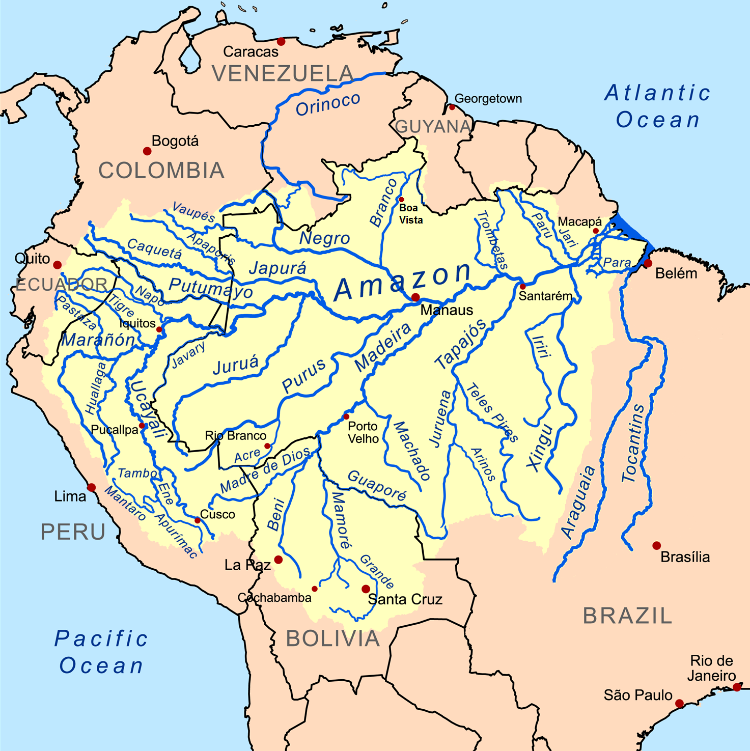
** The Amazon Basin is the world’s largest tropical watershed, spanning eight nations and draining more than 7 million km² of South America through the Amazon River and its myriad tributaries.
**CONTENT:**
## Overview
The Amazon Basin, often called the “lungs of the planet,” is a colossal hydrological system that captures rainwater from the Andes to the Atlantic Ocean. Covering roughly **7 million square kilometres**—about 40 % of the South American continent—it encompasses dense rainforests, floodplain savannas, and towering mountain foothills. The basin’s centerpiece, the **Amazon River**, stretches over **6 400 km**, making it the second‑longest river on Earth and the largest by discharge, delivering an average of **209 000 m³ s⁻¹** of fresh water to the ocean each second.
The region’s climate is equatorial, with annual precipitation exceeding **2 000 mm** in many locales, fostering unparalleled biodiversity. More than **10 %** of all known species—ranging from jaguars and pink river dolphins to countless insects and epiphytes—call the basin home. Human presence is equally diverse: Indigenous peoples such as the **Yanomami**, **Kayapo**, and **Asháninka** have inhabited the forest for millennia, while burgeoning cities like **Manaus**, **Belém**, and **Iquitos** serve as economic hubs for timber, fisheries, and increasingly, ecotourism.
## History/Background
Geologically, the Amazon Basin began forming during the **Cretaceous period**, when the ancient South American plate collided with the Caribbean plate, creating the Andes and redirecting water flow eastward. Over the past **10 million years**, the basin has oscillated between wet and dry phases, shaping its complex mosaic of terra firme forests, varzea floodplains, and igapó black‑water swamps.
European contact commenced in the early **16th century**, with Spanish explorer **Francisco de Orellana** becoming the first known European to navigate the entire length of the Amazon River in 1541–1542. The subsequent centuries saw the rise of rubber extraction (the **“rubber boom”** of the late 1800s to early 1900s), which brought both economic growth and severe exploitation of Indigenous labor. In the mid‑20th century, the construction of the **Trans‑Amazonian Highway** and the **Belo Monte Dam** sparked intense debate over development versus conservation. International attention peaked in the **1990s** with the **Amazonia Summit** (1992) and the **UN‑Rio Earth Summit** (1992), which codified the basin’s global ecological importance and spurred the creation of numerous protected areas.
## Key Information
- **Area:** ~7 million km² (≈ 2.7 million sq mi)
- **Countries:** Brazil (≈ 60 % of basin), Peru, Colombia, Bolivia, Ecuador, Venezuela, Guyana, Suriname, French Guiana
- **Population:** ~30 million people (≈ 15 % of Brazil’s total)
- **River Length:** Amazon River ~6 400 km; major tributaries include the **Madeira**, **Negro**, **Xingu**, **Tapajós**, and **Juruá**
- **Biodiversity:** > 40 000 plant species, 2 200 fish species, 1 300 bird species, 430 mammal species
- **Carbon Storage:** Forests store **≈ 100 billion tons** of carbon, acting as a critical buffer against climate change
- **Economic Activities:** Sustainable timber, Brazil nut harvesting, fisheries, hydroelectric power (e.g., **Itaipu Dam**), and growing ecotourism sector
- **Threats:** Deforestation (≈ 17 % loss since 1970), illegal mining, climate‑induced droughts, and infrastructure projects that fragment habitats
## Significance
The Amazon Basin’s influence extends far beyond its geographic boundaries. Its massive **carbon sequestration** capacity helps regulate global climate, while the continuous release of water vapor fuels atmospheric circulation patterns that affect rainfall in North America, Africa, and even the Indian subcontinent. Ecologically, the basin serves as a living laboratory for evolutionary biology, offering insights into species adaptation and ecosystem resilience.
Culturally, the basin is a cradle of Indigenous knowledge systems that have stewarded the forest for thousands of years, providing sustainable practices now being integrated into modern conservation strategies. Economically, the basin underpins Brazil’s export economy through commodities like **açaí**, **cocoa**, and **timber**, while also presenting opportunities for **green finance** and **carbon credit markets**.
In the political arena, the Amazon Basin is a focal point of international environmental diplomacy. Agreements such as the **Paris Climate Accord** and the **Amazon Cooperation Treaty Organization (ACTO)** reflect a collective acknowledgment that protecting this watershed is essential for planetary health. The basin’s future hinges on balancing development needs with rigorous preservation, making it a barometer for humanity’s ability to coexist with nature.
**INFOBOX:**
- Name: Amazon Basin
- Type: River drainage basin / tropical rainforest ecosystem
- Date: Formed over the past 10 million years (modern configuration solidified ~2 million years ago)
- Location: Northern South America, spanning Brazil, Peru, Colombia, Bolivia, Ecuador, Venezuela, Guyana, Suriname, and French Guiana
- Known For: Largest tropical watershed, unparalleled biodiversity, critical carbon sink, cultural heritage of Indigenous peoples
**TAGS:** Amazon River, rainforest, biodiversity, climate change, South America, Indigenous cultures, hydroelectric power, deforestation
Marco Wanderer
10
Amazon Basin
** The Amazon Basin is the world’s largest tropical watershed, spanning eight nations and draining more than 7 million km² of South America through the Amazon River and its myriad tributaries.
**CONTENT:**
## Overview
The Amazon Basin, often called the “lungs of the planet,” is a colossal hydrological system that captures rainwater from the Andes to the Atlantic Ocean. Covering roughly **7 million square kilometres**—about 40 % of the South American continent—it encompasses dense rainforests, floodplain savannas, and towering mountain foothills. The basin’s centerpiece, the **Amazon River**, stretches over **6 400 km**, making it the second‑longest river on Earth and the largest by discharge, delivering an average of **209 000 m³ s⁻¹** of fresh water to the ocean each second.
The region’s climate is equatorial, with annual precipitation exceeding **2 000 mm** in many locales, fostering unparalleled biodiversity. More than **10 %** of all known species—ranging from jaguars and pink river dolphins to countless insects and epiphytes—call the basin home. Human presence is equally diverse: Indigenous peoples such as the **Yanomami**, **Kayapo**, and **Asháninka** have inhabited the forest for millennia, while burgeoning cities like **Manaus**, **Belém**, and **Iquitos** serve as economic hubs for timber, fisheries, and increasingly, ecotourism.
## History/Background
Geologically, the Amazon Basin began forming during the **Cretaceous period**, when the ancient South American plate collided with the Caribbean plate, creating the Andes and redirecting water flow eastward. Over the past **10 million years**, the basin has oscillated between wet and dry phases, shaping its complex mosaic of terra firme forests, varzea floodplains, and igapó black‑water swamps.
European contact commenced in the early **16th century**, with Spanish explorer **Francisco de Orellana** becoming the first known European to navigate the entire length of the Amazon River in 1541–1542. The subsequent centuries saw the rise of rubber extraction (the **“rubber boom”** of the late 1800s to early 1900s), which brought both economic growth and severe exploitation of Indigenous labor. In the mid‑20th century, the construction of the **Trans‑Amazonian Highway** and the **Belo Monte Dam** sparked intense debate over development versus conservation. International attention peaked in the **1990s** with the **Amazonia Summit** (1992) and the **UN‑Rio Earth Summit** (1992), which codified the basin’s global ecological importance and spurred the creation of numerous protected areas.
## Key Information
- **Area:** ~7 million km² (≈ 2.7 million sq mi)
- **Countries:** Brazil (≈ 60 % of basin), Peru, Colombia, Bolivia, Ecuador, Venezuela, Guyana, Suriname, French Guiana
- **Population:** ~30 million people (≈ 15 % of Brazil’s total)
- **River Length:** Amazon River ~6 400 km; major tributaries include the **Madeira**, **Negro**, **Xingu**, **Tapajós**, and **Juruá**
- **Biodiversity:** > 40 000 plant species, 2 200 fish species, 1 300 bird species, 430 mammal species
- **Carbon Storage:** Forests store **≈ 100 billion tons** of carbon, acting as a critical buffer against climate change
- **Economic Activities:** Sustainable timber, Brazil nut harvesting, fisheries, hydroelectric power (e.g., **Itaipu Dam**), and growing ecotourism sector
- **Threats:** Deforestation (≈ 17 % loss since 1970), illegal mining, climate‑induced droughts, and infrastructure projects that fragment habitats
## Significance
The Amazon Basin’s influence extends far beyond its geographic boundaries. Its massive **carbon sequestration** capacity helps regulate global climate, while the continuous release of water vapor fuels atmospheric circulation patterns that affect rainfall in North America, Africa, and even the Indian subcontinent. Ecologically, the basin serves as a living laboratory for evolutionary biology, offering insights into species adaptation and ecosystem resilience.
Culturally, the basin is a cradle of Indigenous knowledge systems that have stewarded the forest for thousands of years, providing sustainable practices now being integrated into modern conservation strategies. Economically, the basin underpins Brazil’s export economy through commodities like **açaí**, **cocoa**, and **timber**, while also presenting opportunities for **green finance** and **carbon credit markets**.
In the political arena, the Amazon Basin is a focal point of international environmental diplomacy. Agreements such as the **Paris Climate Accord** and the **Amazon Cooperation Treaty Organization (ACTO)** reflect a collective acknowledgment that protecting this watershed is essential for planetary health. The basin’s future hinges on balancing development needs with rigorous preservation, making it a barometer for humanity’s ability to coexist with nature.
**INFOBOX:**
- Name: Amazon Basin
- Type: River drainage basin / tropical rainforest ecosystem
- Date: Formed over the past 10 million years (modern configuration solidified ~2 million years ago)
- Location: Northern South America, spanning Brazil, Peru, Colombia, Bolivia, Ecuador, Venezuela, Guyana, Suriname, and French Guiana
- Known For: Largest tropical watershed, unparalleled biodiversity, critical carbon sink, cultural heritage of Indigenous peoples
**TAGS:** Amazon River, rainforest, biodiversity, climate change, South America, Indigenous cultures, hydroelectric power, deforestation
Marco Wanderer
10
 Amazon Rainforest
The Amazon Rainforest is the world’s largest tropical moist broadleaf forest, spanning roughly six million square kilometres across nine South American nations and harboring unparalleled biodiversity and cultural heritage.
Marco Wanderer
21
Amazon Rainforest
The Amazon Rainforest is the world’s largest tropical moist broadleaf forest, spanning roughly six million square kilometres across nine South American nations and harboring unparalleled biodiversity and cultural heritage.
Marco Wanderer
21
 Amsterdam
, the capital and largest city of the Netherlands, is a historic and culturally rich city known for its stunning canals, vibrant arts scene, and tolerant attitude, earning it the nickname "Venice of the North".
Marco Wanderer
8
Amsterdam
Amsterdam, the capital and largest city of the Netherlands, is a historic and culturally rich city known for its stunning canals, vibrant arts scene, and tolerant attitude, earning it the nickname "Venice of the North".
Marco Wanderer
8
 Andalusia
** Andalusia is Spain’s sun‑kissed southern autonomous community, famed for its rich Moorish heritage, vibrant culture, and diverse landscapes ranging from Mediterranean beaches to snowy Sierra Nevada peaks.
**CONTENT:**
## Overview
Andalusia (**Andalucía** in Spanish) stretches across the southernmost tip of the Iberian Peninsula, covering roughly 87,600 km² and home to more than 8.5 million inhabitants. Its capital, **Seville**, pulsates with flamenco rhythm, historic architecture, and the grand Plaza de España, while the **High Court of Justice** sits in the storied city of **Granada**, overlooking the Alhambra’s ivory towers. The region is divided into eight provinces—**Almería, Cádiz, Córdoba, Granada, Huelva, Jaén, Málaga**, and **Seville**—each offering a distinct blend of coastal charm, fertile valleys, and rugged mountain terrain.
Geographically, Andalusia boasts a striking diversity: the **Costa del Sol** and **Costa de la Luz** lure sun‑seekers with golden sands; the **Sierra Nevada** hosts Spain’s highest mainland peak, Mulhacén (3,479 m); and the **Doñana National Park** protects vital wetlands that serve as a sanctuary for migratory birds. This mosaic of environments underpins a robust agricultural sector, especially olive oil production—Andalusia supplies over 70 % of Spain’s olives, making it the world’s leading olive oil exporter.
Culturally, Andalusia is the cradle of flamenco, a UNESCO Intangible Cultural Heritage, and the birthplace of iconic figures such as poet **Federico García Lorca** and explorer **Cristóbal Colón** (Christopher Columbus). Its cities echo with centuries‑old legacies: the Roman aqueduct of **Segovia**, the Moorish **Great Mosque of Córdoba**, and the Renaissance splendor of **Seville’s Cathedral**, the world’s largest Gothic cathedral.
## History/Background
Andalusia’s story begins with prehistoric settlements, but its identity was forged during the **Al-Andalus** period (711 – 1492 CE), when Muslim rulers introduced advanced irrigation, architecture, and scholarship. The **Caliphate of Córdoba** (929‑1031) turned the city into a beacon of learning, rivaling Baghdad and Baghdad’s House of Wisdom. The Reconquista culminated in 1492 with the fall of Granada, the last Muslim stronghold, ushering in a unified Christian Spain under the Catholic Monarchs.
The 19th century saw Andalusia become a hotbed of liberal revolts and agrarian unrest, culminating in the **Spanish Civil War** (1936‑1939), where the region suffered severe repression. Post‑Franco Spain granted Andalusia autonomy in 1981, recognizing it as a **historical nationality** and a **national reality**, a status reflected in its Statute of Autonomy. Since then, the community has pursued economic diversification, investing in tourism, renewable energy, and high‑tech agriculture while preserving its cultural patrimony.
## Key Information
- **Population:** ~8.5 million (2023) – the most populous autonomous community in Spain.
- **Area:** 87,597 km² – second‑largest after Castile‑La Mancha.
- **Provinces:** Almería, Cádiz, Córdoba, Granada, Huelva, Jaén, Málaga, Seville.
- **Capital:** Seville; **High Court of Justice:** Granada.
- **Economy:** Dominated by tourism (≈ 30 % of GDP), olive oil (≈ 70 % of national output), renewable energy (wind farms in the plains, solar plants in Almería).
- **Language:** Spanish (Castilian) is official; Andalusian dialect features distinct phonetics and lexical items.
- **Cultural Highlights:** Flamenco (music, dance, cante), Semana Santa processions, Feria de Abril, Moorish architecture (Alhambra, Alcázar of Seville), and the **Pueblos Blancos** (white‑washed mountain villages).
- **UNESCO Sites:** Alhambra (Granada), Historic Centre of Córdoba, Doñana National Park, and the **Grazalema** Biosphere Reserve.
## Significance
Andalusia’s influence extends far beyond its borders. Its Moorish legacy shaped European art, science, and urban planning, while its agricultural innovations—especially the **acequia** irrigation system—revolutionized water management across the Mediterranean. The region’s flamenco tradition has become a global emblem of passionate expression, inspiring musicians from Buenos Aires to Tokyo. Economically, Andalusia’s olive oil and renewable‑energy sectors contribute substantially to Spain’s export profile and climate‑change mitigation goals.
Socially, Andalusia embodies a resilient identity forged through centuries of conquest, coexistence, and cultural synthesis. Its designation as a **historical nationality** underscores a unique self‑perception that balances regional pride with Spanish unity, influencing contemporary debates on autonomy and cultural preservation. As a gateway between Europe, Africa, and the Atlantic, Andalusia continues to be a crucible of intercultural dialogue, tourism, and innovation, ensuring its legacy endures for generations to come.
**INFOBOX:**
- Name: Andalusia (Andalucía)
- Type: Autonomous community of Spain; historical nationality
- Date: Granted autonomy on 28 April 1981 (Statute of Autonomy)
- Location: Southern Iberian Peninsula, southwestern Europe
- Known For: Moorish heritage, flamenco, olive oil production, diverse landscapes
**TAGS:** Spain, autonomous community, Andalusia, Moorish history, flamenco, olive oil, tourism, cultural heritage
Marco Wanderer
4
Andalusia
** Andalusia is Spain’s sun‑kissed southern autonomous community, famed for its rich Moorish heritage, vibrant culture, and diverse landscapes ranging from Mediterranean beaches to snowy Sierra Nevada peaks.
**CONTENT:**
## Overview
Andalusia (**Andalucía** in Spanish) stretches across the southernmost tip of the Iberian Peninsula, covering roughly 87,600 km² and home to more than 8.5 million inhabitants. Its capital, **Seville**, pulsates with flamenco rhythm, historic architecture, and the grand Plaza de España, while the **High Court of Justice** sits in the storied city of **Granada**, overlooking the Alhambra’s ivory towers. The region is divided into eight provinces—**Almería, Cádiz, Córdoba, Granada, Huelva, Jaén, Málaga**, and **Seville**—each offering a distinct blend of coastal charm, fertile valleys, and rugged mountain terrain.
Geographically, Andalusia boasts a striking diversity: the **Costa del Sol** and **Costa de la Luz** lure sun‑seekers with golden sands; the **Sierra Nevada** hosts Spain’s highest mainland peak, Mulhacén (3,479 m); and the **Doñana National Park** protects vital wetlands that serve as a sanctuary for migratory birds. This mosaic of environments underpins a robust agricultural sector, especially olive oil production—Andalusia supplies over 70 % of Spain’s olives, making it the world’s leading olive oil exporter.
Culturally, Andalusia is the cradle of flamenco, a UNESCO Intangible Cultural Heritage, and the birthplace of iconic figures such as poet **Federico García Lorca** and explorer **Cristóbal Colón** (Christopher Columbus). Its cities echo with centuries‑old legacies: the Roman aqueduct of **Segovia**, the Moorish **Great Mosque of Córdoba**, and the Renaissance splendor of **Seville’s Cathedral**, the world’s largest Gothic cathedral.
## History/Background
Andalusia’s story begins with prehistoric settlements, but its identity was forged during the **Al-Andalus** period (711 – 1492 CE), when Muslim rulers introduced advanced irrigation, architecture, and scholarship. The **Caliphate of Córdoba** (929‑1031) turned the city into a beacon of learning, rivaling Baghdad and Baghdad’s House of Wisdom. The Reconquista culminated in 1492 with the fall of Granada, the last Muslim stronghold, ushering in a unified Christian Spain under the Catholic Monarchs.
The 19th century saw Andalusia become a hotbed of liberal revolts and agrarian unrest, culminating in the **Spanish Civil War** (1936‑1939), where the region suffered severe repression. Post‑Franco Spain granted Andalusia autonomy in 1981, recognizing it as a **historical nationality** and a **national reality**, a status reflected in its Statute of Autonomy. Since then, the community has pursued economic diversification, investing in tourism, renewable energy, and high‑tech agriculture while preserving its cultural patrimony.
## Key Information
- **Population:** ~8.5 million (2023) – the most populous autonomous community in Spain.
- **Area:** 87,597 km² – second‑largest after Castile‑La Mancha.
- **Provinces:** Almería, Cádiz, Córdoba, Granada, Huelva, Jaén, Málaga, Seville.
- **Capital:** Seville; **High Court of Justice:** Granada.
- **Economy:** Dominated by tourism (≈ 30 % of GDP), olive oil (≈ 70 % of national output), renewable energy (wind farms in the plains, solar plants in Almería).
- **Language:** Spanish (Castilian) is official; Andalusian dialect features distinct phonetics and lexical items.
- **Cultural Highlights:** Flamenco (music, dance, cante), Semana Santa processions, Feria de Abril, Moorish architecture (Alhambra, Alcázar of Seville), and the **Pueblos Blancos** (white‑washed mountain villages).
- **UNESCO Sites:** Alhambra (Granada), Historic Centre of Córdoba, Doñana National Park, and the **Grazalema** Biosphere Reserve.
## Significance
Andalusia’s influence extends far beyond its borders. Its Moorish legacy shaped European art, science, and urban planning, while its agricultural innovations—especially the **acequia** irrigation system—revolutionized water management across the Mediterranean. The region’s flamenco tradition has become a global emblem of passionate expression, inspiring musicians from Buenos Aires to Tokyo. Economically, Andalusia’s olive oil and renewable‑energy sectors contribute substantially to Spain’s export profile and climate‑change mitigation goals.
Socially, Andalusia embodies a resilient identity forged through centuries of conquest, coexistence, and cultural synthesis. Its designation as a **historical nationality** underscores a unique self‑perception that balances regional pride with Spanish unity, influencing contemporary debates on autonomy and cultural preservation. As a gateway between Europe, Africa, and the Atlantic, Andalusia continues to be a crucible of intercultural dialogue, tourism, and innovation, ensuring its legacy endures for generations to come.
**INFOBOX:**
- Name: Andalusia (Andalucía)
- Type: Autonomous community of Spain; historical nationality
- Date: Granted autonomy on 28 April 1981 (Statute of Autonomy)
- Location: Southern Iberian Peninsula, southwestern Europe
- Known For: Moorish heritage, flamenco, olive oil production, diverse landscapes
**TAGS:** Spain, autonomous community, Andalusia, Moorish history, flamenco, olive oil, tourism, cultural heritage
Marco Wanderer
4
 Andes Mountains
** The Andes Mountains are the world’s longest continental mountain range, stretching nearly 9,000 km along South America’s western spine and shaping the continent’s climate, cultures, and economies.
**CONTENT:**
## Overview
The **Andes Mountains**, also known as the **Andean Mountain Range**, dominate the western edge of South America, forming a continuous highland that rivals the Himalayas in length and the Rockies in breadth. Spanning roughly **8,900 km (5,500 mi)** from the southern tip of Patagonia to the Caribbean coast of Venezuela, the range varies between **200 km and 700 km** in width and averages **4,000 m (13,000 ft)** in elevation. Its towering peaks, such as **Aconcagua** (6,961 m), the highest point outside Asia, and the volcanic chain of the **Northern Volcanic Zone**, create a dramatic mosaic of glaciers, high plateaus, and deep valleys.
The Andes cut across **seven nations**—Argentina, Chile, Bolivia, Peru, Ecuador, Colombia, and Venezuela—each imprinting distinct cultural and ecological signatures on the mountains. From the arid Atacama Desert in Chile to the lush cloud forests of Ecuador, the range hosts a staggering diversity of biomes, supporting endemic species like the **vicuña**, **Andean condor**, and **spectacled bear**. Human societies have thrived here for millennia, adapting to altitudinal gradients with terraced agriculture, llama herding, and sophisticated irrigation systems that still feed millions today.
## History/Background
Geologically, the Andes are the product of the **subduction of the Nazca Plate beneath the South American Plate**, a process that began in the **Late Cretaceous (≈100 million years ago)** and accelerated during the **Paleogene and Neogene periods**. This tectonic collision uplifted the crust, creating a series of thrust faults, fold belts, and volcanic arcs that continue to shape the landscape. The range’s formation is punctuated by major orogenic phases, notably the **Andean orogeny** (≈30–10 Ma), which gave rise to the present‑day high plateau known as the **Altiplano**.
Human presence dates back at least **12,000 years**, with early hunter‑gatherers exploiting high‑altitude resources. By **≈3,000 BCE**, pre‑Inca cultures such as the **Moche** and **Nazca** cultivated coastal valleys, while the **Tiwanaku** civilization (≈500–1000 CE) flourished on the Altiplano, constructing monumental stone architecture and sophisticated water management. The **Inca Empire** (1438–1533 CE) later unified much of the Andes, engineering an extensive road network—**the Qhapaq Ñan**—that linked distant provinces across rugged terrain. Spanish conquest in the 16th century introduced mining booms, especially for silver at **Potosí**, reshaping demographic and economic patterns that persist today.
## Key Information
- **Length:** ~8,900 km (5,500 mi)
- **Width:** 200–700 km (124–435 mi)
- **Average Elevation:** ~4,000 m (13,000 ft)
- **Highest Peak:** **Aconcagua** (6,961 m / 22,838 ft) in Argentina
- **Countries Traversed:** Argentina, Chile, Bolivia, Peru, Ecuador, Colombia, Venezuela
- **Major Sub‑ranges:** **Cordillera Occidental**, **Cordillera Central**, **Cordillera Oriental**, **Sierra Nevada de Santa Marta** (isolated northern spur)
- **Geological Features:** Active volcanoes (e.g., **Cotopaxi**, **Nevado del Ruiz**), extensive glaciated basins, the **Altiplano** plateau, and the **Atacama Desert**—the driest non‑polar desert on Earth.
- **Biodiversity Hotspots:** **Yungas**, **Páramo**, **Puna**, each harboring unique flora such as **Polylepis** forests and fauna like the **Andean cat**.
- **Economic Contributions:** Mining (copper, silver, lithium), agriculture (potatoes, quinoa, maize), hydroelectric power, tourism (trekking, mountaineering, cultural heritage sites).
## Significance
The Andes are a linchpin of South American identity, influencing climate patterns by intercepting moist Pacific winds, creating rain shadows that sustain deserts, and feeding major river systems—**the Amazon**, **Orinoco**, and **Paraná**—that nourish vast lowland ecosystems. Their mineral wealth underpins national economies; Chile’s copper output, for instance, accounts for a substantial share of global production. Culturally, the mountains are woven into indigenous cosmologies, with **Apus** (mountain spirits) revered in Andean spirituality, and traditional practices such as **qhapaq ñan** pilgrimages persisting alongside modern infrastructure.
Ecologically, the Andes act as a climate refuge, allowing species to migrate vertically in response to warming, making them critical for biodiversity conservation under **climate change** scenarios. The region’s glaciers, however, are receding at unprecedented rates, threatening water security for millions downstream. International initiatives—like the **Andean Community of Nations (CAN)** and UNESCO World Heritage designations—aim to balance development with preservation, recognizing the range’s role as a natural laboratory for geological, biological, and cultural research.
**INFOBOX:**
- Name: **Andes Mountains (Andean Mountain Range)**
- Type: **Continental mountain range**
- Date: **Formed primarily during the Late Cretaceous–Neogene (≈100 Ma to 10 Ma)**
- Location: **Western South America (Argentina, Chile, Bolivia, Peru, Ecuador, Colombia, Venezuela)**
- Known For: **Longest continental mountain range, highest peak outside Asia (Aconcagua), rich mineral resources, cultural heritage of Andean civilizations**
**TAGS:** Andes, South America, mountain range, geology, biodiversity, Inca Empire, mineral resources, climate change
Marco Wanderer
15
Andes Mountains
** The Andes Mountains are the world’s longest continental mountain range, stretching nearly 9,000 km along South America’s western spine and shaping the continent’s climate, cultures, and economies.
**CONTENT:**
## Overview
The **Andes Mountains**, also known as the **Andean Mountain Range**, dominate the western edge of South America, forming a continuous highland that rivals the Himalayas in length and the Rockies in breadth. Spanning roughly **8,900 km (5,500 mi)** from the southern tip of Patagonia to the Caribbean coast of Venezuela, the range varies between **200 km and 700 km** in width and averages **4,000 m (13,000 ft)** in elevation. Its towering peaks, such as **Aconcagua** (6,961 m), the highest point outside Asia, and the volcanic chain of the **Northern Volcanic Zone**, create a dramatic mosaic of glaciers, high plateaus, and deep valleys.
The Andes cut across **seven nations**—Argentina, Chile, Bolivia, Peru, Ecuador, Colombia, and Venezuela—each imprinting distinct cultural and ecological signatures on the mountains. From the arid Atacama Desert in Chile to the lush cloud forests of Ecuador, the range hosts a staggering diversity of biomes, supporting endemic species like the **vicuña**, **Andean condor**, and **spectacled bear**. Human societies have thrived here for millennia, adapting to altitudinal gradients with terraced agriculture, llama herding, and sophisticated irrigation systems that still feed millions today.
## History/Background
Geologically, the Andes are the product of the **subduction of the Nazca Plate beneath the South American Plate**, a process that began in the **Late Cretaceous (≈100 million years ago)** and accelerated during the **Paleogene and Neogene periods**. This tectonic collision uplifted the crust, creating a series of thrust faults, fold belts, and volcanic arcs that continue to shape the landscape. The range’s formation is punctuated by major orogenic phases, notably the **Andean orogeny** (≈30–10 Ma), which gave rise to the present‑day high plateau known as the **Altiplano**.
Human presence dates back at least **12,000 years**, with early hunter‑gatherers exploiting high‑altitude resources. By **≈3,000 BCE**, pre‑Inca cultures such as the **Moche** and **Nazca** cultivated coastal valleys, while the **Tiwanaku** civilization (≈500–1000 CE) flourished on the Altiplano, constructing monumental stone architecture and sophisticated water management. The **Inca Empire** (1438–1533 CE) later unified much of the Andes, engineering an extensive road network—**the Qhapaq Ñan**—that linked distant provinces across rugged terrain. Spanish conquest in the 16th century introduced mining booms, especially for silver at **Potosí**, reshaping demographic and economic patterns that persist today.
## Key Information
- **Length:** ~8,900 km (5,500 mi)
- **Width:** 200–700 km (124–435 mi)
- **Average Elevation:** ~4,000 m (13,000 ft)
- **Highest Peak:** **Aconcagua** (6,961 m / 22,838 ft) in Argentina
- **Countries Traversed:** Argentina, Chile, Bolivia, Peru, Ecuador, Colombia, Venezuela
- **Major Sub‑ranges:** **Cordillera Occidental**, **Cordillera Central**, **Cordillera Oriental**, **Sierra Nevada de Santa Marta** (isolated northern spur)
- **Geological Features:** Active volcanoes (e.g., **Cotopaxi**, **Nevado del Ruiz**), extensive glaciated basins, the **Altiplano** plateau, and the **Atacama Desert**—the driest non‑polar desert on Earth.
- **Biodiversity Hotspots:** **Yungas**, **Páramo**, **Puna**, each harboring unique flora such as **Polylepis** forests and fauna like the **Andean cat**.
- **Economic Contributions:** Mining (copper, silver, lithium), agriculture (potatoes, quinoa, maize), hydroelectric power, tourism (trekking, mountaineering, cultural heritage sites).
## Significance
The Andes are a linchpin of South American identity, influencing climate patterns by intercepting moist Pacific winds, creating rain shadows that sustain deserts, and feeding major river systems—**the Amazon**, **Orinoco**, and **Paraná**—that nourish vast lowland ecosystems. Their mineral wealth underpins national economies; Chile’s copper output, for instance, accounts for a substantial share of global production. Culturally, the mountains are woven into indigenous cosmologies, with **Apus** (mountain spirits) revered in Andean spirituality, and traditional practices such as **qhapaq ñan** pilgrimages persisting alongside modern infrastructure.
Ecologically, the Andes act as a climate refuge, allowing species to migrate vertically in response to warming, making them critical for biodiversity conservation under **climate change** scenarios. The region’s glaciers, however, are receding at unprecedented rates, threatening water security for millions downstream. International initiatives—like the **Andean Community of Nations (CAN)** and UNESCO World Heritage designations—aim to balance development with preservation, recognizing the range’s role as a natural laboratory for geological, biological, and cultural research.
**INFOBOX:**
- Name: **Andes Mountains (Andean Mountain Range)**
- Type: **Continental mountain range**
- Date: **Formed primarily during the Late Cretaceous–Neogene (≈100 Ma to 10 Ma)**
- Location: **Western South America (Argentina, Chile, Bolivia, Peru, Ecuador, Colombia, Venezuela)**
- Known For: **Longest continental mountain range, highest peak outside Asia (Aconcagua), rich mineral resources, cultural heritage of Andean civilizations**
**TAGS:** Andes, South America, mountain range, geology, biodiversity, Inca Empire, mineral resources, climate change
Marco Wanderer
15
 Anne Frank House
The Anne Frank House is a museum located in Amsterdam, Netherlands, dedicated to the life and legacy of Jewish wartime diarist Anne Frank, who wrote her famous diary while hiding from the Nazis during World War II.
Marco Wanderer
14
Anne Frank House
The Anne Frank House is a museum located in Amsterdam, Netherlands, dedicated to the life and legacy of Jewish wartime diarist Anne Frank, who wrote her famous diary while hiding from the Nazis during World War II.
Marco Wanderer
14
 Armenia
** Armenia is a historic, landlocked nation in the Armenian Highlands of West Asia, renowned for its ancient Christian heritage, rugged landscapes, and vibrant cultural legacy.
**CONTENT:**
## Overview
Nestled in the heart of the **Caucasus**, the **Republic of Armenia** occupies roughly **29,743 km²** of mountainous terrain, making it one of the smallest sovereign states in the region. Bordered by **Turkey**, **Georgia**, **Azerbaijan**, **Iran**, and the Azerbaijani exclave of **Nakhchivan**, Armenia’s strategic position has shaped its identity as a crossroads of trade, ideas, and empires. The capital, **Yerevan**, sits on the banks of the Hrazdan River and serves as the nation’s political, economic, and cultural hub, home to over **1.1 million** residents.
Armenia’s geography is defined by the **Armenian Highland**, a plateau punctuated by volcanic peaks, deep river valleys, and the famed **Lake Sevan**, the world’s largest high‑altitude freshwater lake. The climate is continental, with hot, dry summers and cold, snowy winters, fostering a rich biodiversity that includes endemic flora such as the **Armenian oak** and fauna like the **Caucasian leopard**. Despite its modest size, the country boasts a dense tapestry of monasteries, khachkars (cross‑stones), and ancient fortresses that dot the landscape, testifying to a civilization that has endured for millennia.
Modern Armenia is a parliamentary republic with a population of approximately **3.0 million** people. The majority are ethnic Armenians, speaking **Armenian**, an Indo‑European language with its own unique alphabet created by **Mesrop Mashtots** in 405 CE. The nation’s economy blends agriculture, mining (copper, molybdenum, and gold), and a growing tech sector, while diaspora remittances remain a vital source of national income.
## History/Background
Armenia’s roots stretch back to the **Urartian Kingdom** (9th–6th centuries BC), whose capital at **Erebuni** (modern Yerevan) marks the earliest urban settlement in the region. By the 1st century BC, the **Artaxiad** and later **Arsacid** dynasties forged a unified Armenian kingdom that at its zenith under **Tigranes the Great** (95–55 BC) spanned from the Mediterranean to the Caspian Sea. In 301 CE, Armenia became the **first state to adopt Christianity as a state religion**, a milestone that cemented its cultural identity and produced a legacy of churches and monasteries still revered today.
The medieval era saw Armenia divided among Byzantine, Persian, and Arab powers, culminating in the **Bagratid Kingdom** (885–1045) and later the **Zakarid Principality**. The Ottoman and Safavid empires contested the region until the **Treaty of Turkmenchay** (1828) placed Eastern Armenia under Russian rule. After the Russian Revolution, the short‑lived **First Republic of Armenia** (1918–1920) declared independence, only to be incorporated into the **Soviet Union** as the Armenian SSR in 1922. The Soviet period brought industrialization, literacy, and urban growth, but also suppressed nationalist aspirations.
The **collapse of the USSR** in 1991 ushered in Armenia’s modern independence. The ensuing **Nagorno‑Karabakh conflict** with Azerbaijan, a war that erupted in 1992 and flared again in 2020, has profoundly impacted the nation’s foreign policy, economy, and collective memory. Despite these challenges, Armenia has pursued democratic reforms, joined the **Collective Security Treaty Organization (CSTO)**, and cultivated closer ties with the European Union and the United Nations.
## Key Information
- **Capital & Largest City:** Yerevan (population ≈ 1.1 million)
- **Official Language:** Armenian (Western and Eastern dialects)
- **Population:** ~3.0 million (2023 estimate)
- **Area:** 29,743 km²; highest point **Mount Aragats** (4,090 m)
- **Government:** Parliamentary republic; President (head of state) and Prime Minister (head of government)
- **Economy:** GDP ≈ $13 billion; key sectors – mining (copper, molybdenum), agriculture (fruits, grapes, apricots), IT services, tourism
- **Religion:** Predominantly **Armenian Apostolic Church** (≈ 94 %); also Catholic, Protestant, and Muslim minorities
- **Cultural Highlights:** UNESCO World Heritage sites – **Etchmiadzin Cathedral**, **Monastery of Geghard**, **Haghpat and Sanahin Monasteries**; the **Armenian Genocide Memorial** (Tsitsernakaberd) in Yerevan; world‑renowned **Duduk** music and **Khachkar** stone carving.
- **Diaspora:** Over 7 million Armenians live abroad, forming a global network that contributes remittances, cultural exchange, and political advocacy.
## Significance
Armenia’s importance transcends its modest size. As the cradle of the **first Christian state**, it has shaped theological discourse, liturgical art, and ecclesiastical architecture that influence Eastern Orthodoxy and Oriental Christianity. Its **alphabet** and literary tradition, epitomized by medieval poets like **Hovhannes Tumanyan**, preserve a linguistic heritage that survived successive invasions and cultural suppression.
Strategically, Armenia sits at the nexus of Europe and Asia, making it a pivotal player in regional security dynamics, especially regarding the **Nagorno‑Karabakh** dispute and energy corridors linking the Caspian basin to the Mediterranean. The nation’s resilience—evident in its recovery from the 1988 **Spitak earthquake**, the 1990s blockade, and recent conflicts—offers a case study in nation‑building under adversity.
Culturally, Armenia’s contributions to music, cuisine (notably **khorovats**, **dolma**, and **lavash**), and the arts have enriched global heritage. Its diaspora, one of the oldest and most widespread, has fostered transnational networks that amplify Armenian voices in politics, science, and the arts worldwide. In the digital age, Armenia’s burgeoning **tech startup ecosystem**, centered in Yerevan’s “Silicon Valley of the Caucasus,” showcases the country’s capacity for innovation and integration into the global knowledge economy.
**INFOBOX:**
- Name: Republic of Armenia
- Type: Sovereign nation (parliamentary republic)
- Date: Declared independence — 28 May 1991 (modern state)
- Location: Armenian Highlands, South‑Caucasus, West Asia
- Known For: First Christian nation, Armenian alphabet, rich monastic heritage, diaspora influence
**TAGS:** Armenia, Caucasus, Yerevan, Armenian Apostolic Church, Nagorno‑Karabakh, Armenian diaspora, World Heritage, technology startups
Marco Wanderer
9
Armenia
** Armenia is a historic, landlocked nation in the Armenian Highlands of West Asia, renowned for its ancient Christian heritage, rugged landscapes, and vibrant cultural legacy.
**CONTENT:**
## Overview
Nestled in the heart of the **Caucasus**, the **Republic of Armenia** occupies roughly **29,743 km²** of mountainous terrain, making it one of the smallest sovereign states in the region. Bordered by **Turkey**, **Georgia**, **Azerbaijan**, **Iran**, and the Azerbaijani exclave of **Nakhchivan**, Armenia’s strategic position has shaped its identity as a crossroads of trade, ideas, and empires. The capital, **Yerevan**, sits on the banks of the Hrazdan River and serves as the nation’s political, economic, and cultural hub, home to over **1.1 million** residents.
Armenia’s geography is defined by the **Armenian Highland**, a plateau punctuated by volcanic peaks, deep river valleys, and the famed **Lake Sevan**, the world’s largest high‑altitude freshwater lake. The climate is continental, with hot, dry summers and cold, snowy winters, fostering a rich biodiversity that includes endemic flora such as the **Armenian oak** and fauna like the **Caucasian leopard**. Despite its modest size, the country boasts a dense tapestry of monasteries, khachkars (cross‑stones), and ancient fortresses that dot the landscape, testifying to a civilization that has endured for millennia.
Modern Armenia is a parliamentary republic with a population of approximately **3.0 million** people. The majority are ethnic Armenians, speaking **Armenian**, an Indo‑European language with its own unique alphabet created by **Mesrop Mashtots** in 405 CE. The nation’s economy blends agriculture, mining (copper, molybdenum, and gold), and a growing tech sector, while diaspora remittances remain a vital source of national income.
## History/Background
Armenia’s roots stretch back to the **Urartian Kingdom** (9th–6th centuries BC), whose capital at **Erebuni** (modern Yerevan) marks the earliest urban settlement in the region. By the 1st century BC, the **Artaxiad** and later **Arsacid** dynasties forged a unified Armenian kingdom that at its zenith under **Tigranes the Great** (95–55 BC) spanned from the Mediterranean to the Caspian Sea. In 301 CE, Armenia became the **first state to adopt Christianity as a state religion**, a milestone that cemented its cultural identity and produced a legacy of churches and monasteries still revered today.
The medieval era saw Armenia divided among Byzantine, Persian, and Arab powers, culminating in the **Bagratid Kingdom** (885–1045) and later the **Zakarid Principality**. The Ottoman and Safavid empires contested the region until the **Treaty of Turkmenchay** (1828) placed Eastern Armenia under Russian rule. After the Russian Revolution, the short‑lived **First Republic of Armenia** (1918–1920) declared independence, only to be incorporated into the **Soviet Union** as the Armenian SSR in 1922. The Soviet period brought industrialization, literacy, and urban growth, but also suppressed nationalist aspirations.
The **collapse of the USSR** in 1991 ushered in Armenia’s modern independence. The ensuing **Nagorno‑Karabakh conflict** with Azerbaijan, a war that erupted in 1992 and flared again in 2020, has profoundly impacted the nation’s foreign policy, economy, and collective memory. Despite these challenges, Armenia has pursued democratic reforms, joined the **Collective Security Treaty Organization (CSTO)**, and cultivated closer ties with the European Union and the United Nations.
## Key Information
- **Capital & Largest City:** Yerevan (population ≈ 1.1 million)
- **Official Language:** Armenian (Western and Eastern dialects)
- **Population:** ~3.0 million (2023 estimate)
- **Area:** 29,743 km²; highest point **Mount Aragats** (4,090 m)
- **Government:** Parliamentary republic; President (head of state) and Prime Minister (head of government)
- **Economy:** GDP ≈ $13 billion; key sectors – mining (copper, molybdenum), agriculture (fruits, grapes, apricots), IT services, tourism
- **Religion:** Predominantly **Armenian Apostolic Church** (≈ 94 %); also Catholic, Protestant, and Muslim minorities
- **Cultural Highlights:** UNESCO World Heritage sites – **Etchmiadzin Cathedral**, **Monastery of Geghard**, **Haghpat and Sanahin Monasteries**; the **Armenian Genocide Memorial** (Tsitsernakaberd) in Yerevan; world‑renowned **Duduk** music and **Khachkar** stone carving.
- **Diaspora:** Over 7 million Armenians live abroad, forming a global network that contributes remittances, cultural exchange, and political advocacy.
## Significance
Armenia’s importance transcends its modest size. As the cradle of the **first Christian state**, it has shaped theological discourse, liturgical art, and ecclesiastical architecture that influence Eastern Orthodoxy and Oriental Christianity. Its **alphabet** and literary tradition, epitomized by medieval poets like **Hovhannes Tumanyan**, preserve a linguistic heritage that survived successive invasions and cultural suppression.
Strategically, Armenia sits at the nexus of Europe and Asia, making it a pivotal player in regional security dynamics, especially regarding the **Nagorno‑Karabakh** dispute and energy corridors linking the Caspian basin to the Mediterranean. The nation’s resilience—evident in its recovery from the 1988 **Spitak earthquake**, the 1990s blockade, and recent conflicts—offers a case study in nation‑building under adversity.
Culturally, Armenia’s contributions to music, cuisine (notably **khorovats**, **dolma**, and **lavash**), and the arts have enriched global heritage. Its diaspora, one of the oldest and most widespread, has fostered transnational networks that amplify Armenian voices in politics, science, and the arts worldwide. In the digital age, Armenia’s burgeoning **tech startup ecosystem**, centered in Yerevan’s “Silicon Valley of the Caucasus,” showcases the country’s capacity for innovation and integration into the global knowledge economy.
**INFOBOX:**
- Name: Republic of Armenia
- Type: Sovereign nation (parliamentary republic)
- Date: Declared independence — 28 May 1991 (modern state)
- Location: Armenian Highlands, South‑Caucasus, West Asia
- Known For: First Christian nation, Armenian alphabet, rich monastic heritage, diaspora influence
**TAGS:** Armenia, Caucasus, Yerevan, Armenian Apostolic Church, Nagorno‑Karabakh, Armenian diaspora, World Heritage, technology startups
Marco Wanderer
9
 Auckland
 is a vibrant and culturally diverse metropolitan city in the North Island of New Zealand, known for its stunning natural beauty, rich history, and thriving economy.
Marco Wanderer
11
Auckland
Auckland is a vibrant and culturally diverse metropolitan city in the North Island of New Zealand, known for its stunning natural beauty, rich history, and thriving economy.
Marco Wanderer
11
 Auschwitz
 was a network of concentration and extermination camps operated by Nazi Germany in occupied Poland during World War II, serving as a symbol of the atrocities committed during the Holocaust.
Marco Wanderer
11
Auschwitz
Auschwitz was a network of concentration and extermination camps operated by Nazi Germany in occupied Poland during World War II, serving as a symbol of the atrocities committed during the Holocaust.
Marco Wanderer
11
 Australia
, officially the Commonwealth of Australia, is a country comprising the mainland of the Australian continent, the island of Tasmania and numerous smaller islands. It has a total area of 7,688,287 km2 (2,968,464 sq mi), making it the sixth
Marco Wanderer
24
Ayutthaya
** Ayutthaya is a historic Thai region encompassing a former capital kingdom, a UNESCO‑listed ruin complex, a modern province and city, and a cultural touchstone reflected in everything from naval vessels to football clubs.
**CONTENT:**
## Overview
Nestled 80 km north of Bangkok, **Ayutthaya** (also rendered **Ayudhya** or **Ayuthia**) is synonymous with Thailand’s golden age of architecture, trade, and diplomacy. The name first conjures the **Ayutthaya Kingdom**, a sprawling Siamese empire that flourished from 1350 to 1767, rivaling contemporary powers such as the Ming dynasty and the Mughal Empire. Today, the remnants of that capital are preserved in the **Ayutthaya Historical Park**, a UNESCO World Heritage Site where towering prangs, Buddha statues, and the iconic **Wat Mahathat** silhouette dominate the Chao Phraya River’s floodplain.
Beyond the ruins, **Ayutthaya** lives on as a vibrant administrative region. **Phra Nakhon Si Ayutthaya Province** encircles the historic core, while **Phra Nakhon Si Ayutthaya District** serves as the province’s capital district, housing the modern city of **Phra Nakhon Si Ayutthaya**. The city blends bustling markets, riverside promenades, and a growing tourism infrastructure, making it a living museum where ancient stone meets contemporary Thai life.
The Ayutthaya brand extends into diverse arenas: the Royal Thai Navy christened a frigate **HTMS Sri Ayudhya**, Bangkok’s central artery includes **Si Ayutthaya Road**, and the former **Bank of Ayudhya** (now part of Krungsri) once bore the name. Even nature and sport echo the legacy—**Ayuthia**, a genus of cicadas, and football teams **Ayutthaya United F.C.** and **Bang Pa‑in Ayutthaya F.C.** carry the moniker into modern popular culture.
## History/Background
The kingdom’s foundation is traditionally dated to 1350, when King **Uthong (Ramathibodi I)** established Ayutthaya on the confluence of three rivers—Chao Phraya, Pa Sak, and Lopburi—strategically positioning it for inland and maritime trade. Over the next four centuries, the kingdom expanded through conquest, diplomacy, and marriage alliances, at its height controlling much of modern Thailand, Laos, Cambodia, and parts of Myanmar.
Key dates punctuate its narrative: the 1434–1448 reign of **King Borommatrailokkanat**, who instituted a sophisticated bureaucracy and legal code; the 1569–1590 rule of **King Naresuan**, celebrated for liberating Siam from Burmese domination; and the tragic 1767 sack by the **Burmese Konbaung army**, which razed the capital, ending the kingdom’s era. Survivors fled to Thonburi and later Bangkok, where the new capital was founded by **King Rama I** in 1782.
Centuries later, the Thai government, recognizing the site’s cultural value, designated the ruins as a historical park in 1976. UNESCO’s inscription in 1991 cemented Ayutthaya’s global significance, prompting extensive conservation, archaeological research, and sustainable tourism initiatives that balance preservation with community development.
## Key Information
- **Ayutthaya Kingdom (1350‑1767):** At its zenith, the kingdom spanned ~700,000 km², with an estimated population of 1–2 million. It was a hub for rice, teak, and ceramics, exporting to Europe, China, and the Middle East.
- **Ayutthaya Historical Park:** Encompasses 289 ha of ruins, including 32 major temples and 14 stupas. Highlights include **Wat Phra Si Sanphet**, the former royal chapel, and the **Elephant Kraal**.
- **Phra Nakhon Si Ayutthaya Province:** Covers 2,557 km², home to ~800,000 residents (2023 estimate). The economy blends agriculture (rice, fruit orchards) with tourism, manufacturing, and logistics.
- **HTMS Sri Ayudhya (PF‑2):** Launched in 1975, this frigate served in the Royal Thai Navy until decommissioned in 2000, symbolizing the nation’s maritime heritage.
- **Bank of Ayudhya:** Established in 1945, it grew into one of Thailand’s “Big Four” banks before merging with **Krungsri** in 2015.
- **Ayuthia (cicada):** A monotypic genus described in 1905, endemic to the low‑land forests of central Thailand, illustrating the region’s biodiversity.
- **Ayutthaya United F.C. & Bang Pa‑in Ayutthaya F.C.:** Compete in Thailand’s professional football leagues, fostering local pride and youth development.
## Significance
Ayutthaya’s legacy is a cornerstone of Thai identity. The kingdom’s sophisticated administration, cosmopolitan trade networks, and artistic achievements laid the groundwork for modern Thailand’s political and cultural institutions. Its ruins serve as a tangible reminder of a pre‑colonial Asian empire that engaged globally on equal terms, challenging Eurocentric narratives of world history.
The UNESCO designation has propelled international scholarship, leading to discoveries about Southeast Asian urban planning, hydraulic engineering, and religious syncretism—particularly the blend of Theravada Buddhism with Hindu and Chinese motifs evident in temple art. Economically, the historical park drives a multi‑billion‑baht tourism sector, supporting local artisans, hospitality workers, and conservationists.
Beyond heritage, the Ayutthaya name permeates everyday life: from the **HTMS Sri Ayudhya** symbolizing national defense, to the **Bank of Ayudhya** reflecting financial modernization, to football clubs galvanizing community spirit. Even the cicada genus **Ayuthia** underscores the region’s ecological richness, reminding us that cultural and natural histories are intertwined.
In sum, Ayutthaya is not merely a relic of the past; it is a living, evolving tapestry that continues to shape Thailand’s national narrative, economy, and global image.
**INFOBOX:**
- Name: Ayutthaya (including Ayudhya, Ayuthia)
- Type: Historical kingdom, UNESCO World Heritage site, modern province and city, cultural brand
- Date: 1350 – 1767 (kingdom); 1976 (park establishment); 1991 (UNESCO inscription)
- Location: Central Thailand, on the Chao Phraya River basin
- Known For: Former Siamese capital, spectacular temple ruins, influential trade empire, enduring cultural symbols
**TAGS:** Thailand, Southeast Asia, UNESCO Heritage, historical kingdoms, archaeology, tourism, football, biodiversity
Marco Wanderer
9
Australia
Australia, officially the Commonwealth of Australia, is a country comprising the mainland of the Australian continent, the island of Tasmania and numerous smaller islands. It has a total area of 7,688,287 km2 (2,968,464 sq mi), making it the sixth
Marco Wanderer
24
Ayutthaya
** Ayutthaya is a historic Thai region encompassing a former capital kingdom, a UNESCO‑listed ruin complex, a modern province and city, and a cultural touchstone reflected in everything from naval vessels to football clubs.
**CONTENT:**
## Overview
Nestled 80 km north of Bangkok, **Ayutthaya** (also rendered **Ayudhya** or **Ayuthia**) is synonymous with Thailand’s golden age of architecture, trade, and diplomacy. The name first conjures the **Ayutthaya Kingdom**, a sprawling Siamese empire that flourished from 1350 to 1767, rivaling contemporary powers such as the Ming dynasty and the Mughal Empire. Today, the remnants of that capital are preserved in the **Ayutthaya Historical Park**, a UNESCO World Heritage Site where towering prangs, Buddha statues, and the iconic **Wat Mahathat** silhouette dominate the Chao Phraya River’s floodplain.
Beyond the ruins, **Ayutthaya** lives on as a vibrant administrative region. **Phra Nakhon Si Ayutthaya Province** encircles the historic core, while **Phra Nakhon Si Ayutthaya District** serves as the province’s capital district, housing the modern city of **Phra Nakhon Si Ayutthaya**. The city blends bustling markets, riverside promenades, and a growing tourism infrastructure, making it a living museum where ancient stone meets contemporary Thai life.
The Ayutthaya brand extends into diverse arenas: the Royal Thai Navy christened a frigate **HTMS Sri Ayudhya**, Bangkok’s central artery includes **Si Ayutthaya Road**, and the former **Bank of Ayudhya** (now part of Krungsri) once bore the name. Even nature and sport echo the legacy—**Ayuthia**, a genus of cicadas, and football teams **Ayutthaya United F.C.** and **Bang Pa‑in Ayutthaya F.C.** carry the moniker into modern popular culture.
## History/Background
The kingdom’s foundation is traditionally dated to 1350, when King **Uthong (Ramathibodi I)** established Ayutthaya on the confluence of three rivers—Chao Phraya, Pa Sak, and Lopburi—strategically positioning it for inland and maritime trade. Over the next four centuries, the kingdom expanded through conquest, diplomacy, and marriage alliances, at its height controlling much of modern Thailand, Laos, Cambodia, and parts of Myanmar.
Key dates punctuate its narrative: the 1434–1448 reign of **King Borommatrailokkanat**, who instituted a sophisticated bureaucracy and legal code; the 1569–1590 rule of **King Naresuan**, celebrated for liberating Siam from Burmese domination; and the tragic 1767 sack by the **Burmese Konbaung army**, which razed the capital, ending the kingdom’s era. Survivors fled to Thonburi and later Bangkok, where the new capital was founded by **King Rama I** in 1782.
Centuries later, the Thai government, recognizing the site’s cultural value, designated the ruins as a historical park in 1976. UNESCO’s inscription in 1991 cemented Ayutthaya’s global significance, prompting extensive conservation, archaeological research, and sustainable tourism initiatives that balance preservation with community development.
## Key Information
- **Ayutthaya Kingdom (1350‑1767):** At its zenith, the kingdom spanned ~700,000 km², with an estimated population of 1–2 million. It was a hub for rice, teak, and ceramics, exporting to Europe, China, and the Middle East.
- **Ayutthaya Historical Park:** Encompasses 289 ha of ruins, including 32 major temples and 14 stupas. Highlights include **Wat Phra Si Sanphet**, the former royal chapel, and the **Elephant Kraal**.
- **Phra Nakhon Si Ayutthaya Province:** Covers 2,557 km², home to ~800,000 residents (2023 estimate). The economy blends agriculture (rice, fruit orchards) with tourism, manufacturing, and logistics.
- **HTMS Sri Ayudhya (PF‑2):** Launched in 1975, this frigate served in the Royal Thai Navy until decommissioned in 2000, symbolizing the nation’s maritime heritage.
- **Bank of Ayudhya:** Established in 1945, it grew into one of Thailand’s “Big Four” banks before merging with **Krungsri** in 2015.
- **Ayuthia (cicada):** A monotypic genus described in 1905, endemic to the low‑land forests of central Thailand, illustrating the region’s biodiversity.
- **Ayutthaya United F.C. & Bang Pa‑in Ayutthaya F.C.:** Compete in Thailand’s professional football leagues, fostering local pride and youth development.
## Significance
Ayutthaya’s legacy is a cornerstone of Thai identity. The kingdom’s sophisticated administration, cosmopolitan trade networks, and artistic achievements laid the groundwork for modern Thailand’s political and cultural institutions. Its ruins serve as a tangible reminder of a pre‑colonial Asian empire that engaged globally on equal terms, challenging Eurocentric narratives of world history.
The UNESCO designation has propelled international scholarship, leading to discoveries about Southeast Asian urban planning, hydraulic engineering, and religious syncretism—particularly the blend of Theravada Buddhism with Hindu and Chinese motifs evident in temple art. Economically, the historical park drives a multi‑billion‑baht tourism sector, supporting local artisans, hospitality workers, and conservationists.
Beyond heritage, the Ayutthaya name permeates everyday life: from the **HTMS Sri Ayudhya** symbolizing national defense, to the **Bank of Ayudhya** reflecting financial modernization, to football clubs galvanizing community spirit. Even the cicada genus **Ayuthia** underscores the region’s ecological richness, reminding us that cultural and natural histories are intertwined.
In sum, Ayutthaya is not merely a relic of the past; it is a living, evolving tapestry that continues to shape Thailand’s national narrative, economy, and global image.
**INFOBOX:**
- Name: Ayutthaya (including Ayudhya, Ayuthia)
- Type: Historical kingdom, UNESCO World Heritage site, modern province and city, cultural brand
- Date: 1350 – 1767 (kingdom); 1976 (park establishment); 1991 (UNESCO inscription)
- Location: Central Thailand, on the Chao Phraya River basin
- Known For: Former Siamese capital, spectacular temple ruins, influential trade empire, enduring cultural symbols
**TAGS:** Thailand, Southeast Asia, UNESCO Heritage, historical kingdoms, archaeology, tourism, football, biodiversity
Marco Wanderer
9
 Azerbaijan
** Azerbaijan is a transcontinental republic at the crossroads of Western Asia and Eastern Europe, famed for its rich cultural tapestry, oil wealth, and the glittering capital city of Baku on the Caspian Sea.
**CONTENT:**
## Overview
Nestled in the South Caucasus, the **Republic of Azerbaijan** bridges the continents of Europe and Asia, offering a striking blend of ancient heritage and modern ambition. Bordered by the **Caspian Sea** to the east, Russia’s Dagestan to the north, Georgia to the northwest, Armenia and Turkey to the west, and Iran to the south, Azerbaijan occupies a strategic corridor that has long attracted traders, conquerors, and explorers. Its varied landscape ranges from the flat, oil‑rich lowlands along the Caspian shoreline to the soaring peaks of the Greater Caucasus in the north and the semi‑arid plains of the central steppe.
Azerbaijan’s population of roughly **10 million** people is a mosaic of ethnicities, with **Azeris** forming the majority, alongside sizable **Lezgins, Talysh, Kurds,** and **Georgians**. The official language is **Azerbaijani (Azeri)**, a Turkic tongue written in a modified Latin script since 1991. Islam, predominantly **Shia**, shapes much of public life, yet the nation prides itself on a secular constitution that guarantees religious freedom. Baku, the capital, dazzles with its futuristic skyline—most famously the **Flame Towers**—while preserving historic quarters like **Icherisheher**, a UNESCO World Heritage site.
Economically, Azerbaijan is a **hydrocarbon powerhouse**. The discovery of vast oil and natural gas reserves in the 20th century transformed the country into a key energy exporter, funding ambitious infrastructure projects and a burgeoning service sector. At the same time, the government is diversifying into **tourism, agriculture,** and **information technology**, positioning Azerbaijan as a regional hub for trade and culture.
## History/Background
Azerbaijan’s story stretches back to antiquity, when the region formed part of the **Caucasian Albanian** kingdom and later fell under **Persian** and **Arab** influence. The medieval era saw the rise of the **Shirvanshahs**, a native dynasty that fostered poetry, architecture, and trade along the Silk Road. In the 16th century, the **Safavid Empire** incorporated the territory, cementing Shi’a Islam as the dominant faith.
The 19th century ushered in Russian domination after the **Treaty of Gulistan (1813)** and **Treaty of Turkmenchay (1828)**, integrating Azerbaijan into the Russian Empire. The brief **Azerbaijan Democratic Republic** (1918‑1920) marked the world’s first secular, democratic Muslim-majority state, but Soviet annexation in 1920 ended its independence. Under Soviet rule, Baku’s oil fueled the war effort, and the republic experienced rapid industrialization and urbanization.
The **collapse of the USSR** in 1991 restored Azerbaijan’s sovereignty on **October 18, 1991**. The early post‑independence years were turbulent, marked by the **Nagorno‑Karabakh conflict** with Armenia, economic hardship, and political upheaval. The election of **Heydar Aliyev** in 1993 stabilized the nation, and his son **Ilham Aliyev**, president since 2003, has overseen a period of economic growth driven by energy exports, alongside controversial governance practices.
## Key Information
- **Capital & Largest City:** **Baku**, home to over 2 million residents.
- **Area:** **86,600 km²** (33,400 sq mi), making it the 112th largest country.
- **Population:** Approximately **10.2 million** (2023 estimate).
- **Official Language:** **Azerbaijani** (Azeri).
- **Government:** Unitary semi‑presidential republic.
- **Economy:** GDP per capita (PPP) ≈ **$30,000**; oil and gas account for **≈ 70 %** of export earnings.
- **Currency:** **Azerbaijani manat (AZN)**.
- **Religion:** **≈ 85 % Shia Islam**, with Sunni minorities and Christian, Jewish, and Zoroastrian communities.
- **Cultural Highlights:** Mugham music, carpet weaving, **Novruz** spring festival, and the **Ashiq** bardic tradition.
- **World Heritage Sites:** **Walled City of Baku**, **Gobustan Rock Art**, **Sheki Khan’s Palace**, among others.
- **Strategic Projects:** The **Baku–Tbilisi–Ceyhan (BTC) pipeline**, **Southern Gas Corridor**, and the **Baku International Sea Trade Port**.
## Significance
Azerbaijan’s geopolitical position makes it a linchpin in Eurasian energy politics, linking Caspian oil to European markets while balancing relationships with Russia, Turkey, and Iran. Its **energy revenues** have funded a rapid modernization drive, turning Baku into a cosmopolitan metropolis that hosts international forums such as the **European Games (2015)** and the **Formula 1 Azerbaijan Grand Prix**. Culturally, Azerbaijan serves as a bridge between Turkic, Persian, and Caucasian worlds, preserving unique traditions like **Carpet weaving**—recognized by UNESCO as intangible heritage—while fostering contemporary arts through institutions like the **Baku Museum of Modern Art**.
The ongoing **Nagorno‑Karabakh conflict** underscores the nation’s complex ethnic and territorial challenges, influencing regional security dynamics. Simultaneously, Azerbaijan’s commitment to **soft power**—through cultural diplomacy, diaspora networks, and hosting global events—enhances its international profile. As it navigates economic diversification, environmental stewardship of the Caspian basin, and democratic reforms, Azerbaijan remains a compelling case study of a post‑Soviet state striving to define its identity on the world stage.
**INFOBOX:**
- **Name:** Republic of Azerbaijan
- **Type:** Sovereign nation (unitary semi‑presidential republic)
- **Date:** Independence restored — 18 October 1991
- **Location:** South Caucasus, transcontinental (Western Asia & Eastern Europe)
- **Known For:** Oil and natural gas reserves, Baku’s modern skyline, rich cultural heritage, strategic energy corridors
**TAGS:** Azerbaijan, South Caucasus, Baku, Caspian Sea, Energy, History, Culture, Geography
Marco Wanderer
8
Bagan Temples
The **Bagan temples**, a vast and ancient complex of Buddhist temples, pagodas, and stupas, are a testament to the rich cultural and spiritual heritage of Myanmar, showcasing the country's architectural, artistic, and historical significance.
Marco Wanderer
9
Azerbaijan
** Azerbaijan is a transcontinental republic at the crossroads of Western Asia and Eastern Europe, famed for its rich cultural tapestry, oil wealth, and the glittering capital city of Baku on the Caspian Sea.
**CONTENT:**
## Overview
Nestled in the South Caucasus, the **Republic of Azerbaijan** bridges the continents of Europe and Asia, offering a striking blend of ancient heritage and modern ambition. Bordered by the **Caspian Sea** to the east, Russia’s Dagestan to the north, Georgia to the northwest, Armenia and Turkey to the west, and Iran to the south, Azerbaijan occupies a strategic corridor that has long attracted traders, conquerors, and explorers. Its varied landscape ranges from the flat, oil‑rich lowlands along the Caspian shoreline to the soaring peaks of the Greater Caucasus in the north and the semi‑arid plains of the central steppe.
Azerbaijan’s population of roughly **10 million** people is a mosaic of ethnicities, with **Azeris** forming the majority, alongside sizable **Lezgins, Talysh, Kurds,** and **Georgians**. The official language is **Azerbaijani (Azeri)**, a Turkic tongue written in a modified Latin script since 1991. Islam, predominantly **Shia**, shapes much of public life, yet the nation prides itself on a secular constitution that guarantees religious freedom. Baku, the capital, dazzles with its futuristic skyline—most famously the **Flame Towers**—while preserving historic quarters like **Icherisheher**, a UNESCO World Heritage site.
Economically, Azerbaijan is a **hydrocarbon powerhouse**. The discovery of vast oil and natural gas reserves in the 20th century transformed the country into a key energy exporter, funding ambitious infrastructure projects and a burgeoning service sector. At the same time, the government is diversifying into **tourism, agriculture,** and **information technology**, positioning Azerbaijan as a regional hub for trade and culture.
## History/Background
Azerbaijan’s story stretches back to antiquity, when the region formed part of the **Caucasian Albanian** kingdom and later fell under **Persian** and **Arab** influence. The medieval era saw the rise of the **Shirvanshahs**, a native dynasty that fostered poetry, architecture, and trade along the Silk Road. In the 16th century, the **Safavid Empire** incorporated the territory, cementing Shi’a Islam as the dominant faith.
The 19th century ushered in Russian domination after the **Treaty of Gulistan (1813)** and **Treaty of Turkmenchay (1828)**, integrating Azerbaijan into the Russian Empire. The brief **Azerbaijan Democratic Republic** (1918‑1920) marked the world’s first secular, democratic Muslim-majority state, but Soviet annexation in 1920 ended its independence. Under Soviet rule, Baku’s oil fueled the war effort, and the republic experienced rapid industrialization and urbanization.
The **collapse of the USSR** in 1991 restored Azerbaijan’s sovereignty on **October 18, 1991**. The early post‑independence years were turbulent, marked by the **Nagorno‑Karabakh conflict** with Armenia, economic hardship, and political upheaval. The election of **Heydar Aliyev** in 1993 stabilized the nation, and his son **Ilham Aliyev**, president since 2003, has overseen a period of economic growth driven by energy exports, alongside controversial governance practices.
## Key Information
- **Capital & Largest City:** **Baku**, home to over 2 million residents.
- **Area:** **86,600 km²** (33,400 sq mi), making it the 112th largest country.
- **Population:** Approximately **10.2 million** (2023 estimate).
- **Official Language:** **Azerbaijani** (Azeri).
- **Government:** Unitary semi‑presidential republic.
- **Economy:** GDP per capita (PPP) ≈ **$30,000**; oil and gas account for **≈ 70 %** of export earnings.
- **Currency:** **Azerbaijani manat (AZN)**.
- **Religion:** **≈ 85 % Shia Islam**, with Sunni minorities and Christian, Jewish, and Zoroastrian communities.
- **Cultural Highlights:** Mugham music, carpet weaving, **Novruz** spring festival, and the **Ashiq** bardic tradition.
- **World Heritage Sites:** **Walled City of Baku**, **Gobustan Rock Art**, **Sheki Khan’s Palace**, among others.
- **Strategic Projects:** The **Baku–Tbilisi–Ceyhan (BTC) pipeline**, **Southern Gas Corridor**, and the **Baku International Sea Trade Port**.
## Significance
Azerbaijan’s geopolitical position makes it a linchpin in Eurasian energy politics, linking Caspian oil to European markets while balancing relationships with Russia, Turkey, and Iran. Its **energy revenues** have funded a rapid modernization drive, turning Baku into a cosmopolitan metropolis that hosts international forums such as the **European Games (2015)** and the **Formula 1 Azerbaijan Grand Prix**. Culturally, Azerbaijan serves as a bridge between Turkic, Persian, and Caucasian worlds, preserving unique traditions like **Carpet weaving**—recognized by UNESCO as intangible heritage—while fostering contemporary arts through institutions like the **Baku Museum of Modern Art**.
The ongoing **Nagorno‑Karabakh conflict** underscores the nation’s complex ethnic and territorial challenges, influencing regional security dynamics. Simultaneously, Azerbaijan’s commitment to **soft power**—through cultural diplomacy, diaspora networks, and hosting global events—enhances its international profile. As it navigates economic diversification, environmental stewardship of the Caspian basin, and democratic reforms, Azerbaijan remains a compelling case study of a post‑Soviet state striving to define its identity on the world stage.
**INFOBOX:**
- **Name:** Republic of Azerbaijan
- **Type:** Sovereign nation (unitary semi‑presidential republic)
- **Date:** Independence restored — 18 October 1991
- **Location:** South Caucasus, transcontinental (Western Asia & Eastern Europe)
- **Known For:** Oil and natural gas reserves, Baku’s modern skyline, rich cultural heritage, strategic energy corridors
**TAGS:** Azerbaijan, South Caucasus, Baku, Caspian Sea, Energy, History, Culture, Geography
Marco Wanderer
8
Bagan Temples
The **Bagan temples**, a vast and ancient complex of Buddhist temples, pagodas, and stupas, are a testament to the rich cultural and spiritual heritage of Myanmar, showcasing the country's architectural, artistic, and historical significance.
Marco Wanderer
9
 Baghdad
, the capital and largest city of Iraq, is a culturally rich and historically significant metropolis situated on the banks of the Tigris River, boasting a population of over 8 million and serving as a vital financial and commercial hub in the Middle East.
## Overview
Baghdad, also known as the "City of Peace," is a city of immense cultural and historical significance, nestled in the heart of Iraq. The city's strategic location on the banks of the Tigris River has made it a hub of trade and commerce for thousands of years, attracting merchants, travelers, and scholars from all over the world. With a rich history dating back to the 8th century, Baghdad has been a center of learning, art, and architecture, influencing the development of Islamic civilization and leaving a lasting legacy in the region.
As the capital of Iraq, Baghdad is the country's largest city, accounting for 22% of the country's population. The city's diverse population is a reflection of its history, with people from various ethnic and religious backgrounds living together, creating a unique cultural tapestry. Baghdad is a city of contrasts, where ancient mosques and palaces stand alongside modern skyscrapers and shopping malls, showcasing the city's blend of traditional and modern architecture.
## History/Background
Baghdad's history began in 762 CE, when the Abbasid Caliph Al-Mansur founded the city as the capital of the Abbasid Caliphate. The city quickly grew into a center of learning and culture, attracting scholars, poets, and scientists from all over the Islamic world. During the Golden Age of Islam, Baghdad was a hub of intellectual and artistic activity, producing some of the most influential works of literature, science, and philosophy in human history.
The city's strategic location made it a target for various empires and conquerors, including the Mongols, who sacked the city in 1258 CE, destroying much of its infrastructure and cultural heritage. However, Baghdad continued to thrive, and in the 16th century, it became the capital of the Ottoman Empire's Iraqi province. The city's rich history is reflected in its architecture, with many ancient mosques, palaces, and monuments still standing today.
## Key Information
* **Population:** Over 8 million
* **Area:** Approximately 204 square kilometers
* **Location:** Central Iraq, on the banks of the Tigris River
* **Language:** Arabic (official), Kurdish, Turkish, and English
* **Currency:** Iraqi Dinar
* **Economy:** Primarily based on services, trade, and commerce
* **Climate:** Hot desert climate, with very hot summers and mild winters
## Significance
Baghdad's significance extends far beyond its status as the capital of Iraq. The city is a cultural and historical treasure trove, with a rich legacy that has influenced the development of Islamic civilization and beyond. As a center of trade and commerce, Baghdad has played a vital role in shaping the region's economy and politics. The city's diverse population and cultural heritage make it a unique and fascinating place, attracting tourists, scholars, and travelers from all over the world.
INFOBOX:
- Name: Baghdad
- Type: Capital city
- Date: Founded in 762 CE
- Location: Central Iraq, on the banks of the Tigris River
- Known For: Rich cultural and historical heritage, strategic location, and significant influence on Islamic civilization
TAGS: Baghdad, Iraq, Middle East, Arab world, Islamic civilization, Tigris River, trade, commerce, culture, history, architecture, tourism.
Marco Wanderer
8
Baghdad
Baghdad, the capital and largest city of Iraq, is a culturally rich and historically significant metropolis situated on the banks of the Tigris River, boasting a population of over 8 million and serving as a vital financial and commercial hub in the Middle East.
## Overview
Baghdad, also known as the "City of Peace," is a city of immense cultural and historical significance, nestled in the heart of Iraq. The city's strategic location on the banks of the Tigris River has made it a hub of trade and commerce for thousands of years, attracting merchants, travelers, and scholars from all over the world. With a rich history dating back to the 8th century, Baghdad has been a center of learning, art, and architecture, influencing the development of Islamic civilization and leaving a lasting legacy in the region.
As the capital of Iraq, Baghdad is the country's largest city, accounting for 22% of the country's population. The city's diverse population is a reflection of its history, with people from various ethnic and religious backgrounds living together, creating a unique cultural tapestry. Baghdad is a city of contrasts, where ancient mosques and palaces stand alongside modern skyscrapers and shopping malls, showcasing the city's blend of traditional and modern architecture.
## History/Background
Baghdad's history began in 762 CE, when the Abbasid Caliph Al-Mansur founded the city as the capital of the Abbasid Caliphate. The city quickly grew into a center of learning and culture, attracting scholars, poets, and scientists from all over the Islamic world. During the Golden Age of Islam, Baghdad was a hub of intellectual and artistic activity, producing some of the most influential works of literature, science, and philosophy in human history.
The city's strategic location made it a target for various empires and conquerors, including the Mongols, who sacked the city in 1258 CE, destroying much of its infrastructure and cultural heritage. However, Baghdad continued to thrive, and in the 16th century, it became the capital of the Ottoman Empire's Iraqi province. The city's rich history is reflected in its architecture, with many ancient mosques, palaces, and monuments still standing today.
## Key Information
* **Population:** Over 8 million
* **Area:** Approximately 204 square kilometers
* **Location:** Central Iraq, on the banks of the Tigris River
* **Language:** Arabic (official), Kurdish, Turkish, and English
* **Currency:** Iraqi Dinar
* **Economy:** Primarily based on services, trade, and commerce
* **Climate:** Hot desert climate, with very hot summers and mild winters
## Significance
Baghdad's significance extends far beyond its status as the capital of Iraq. The city is a cultural and historical treasure trove, with a rich legacy that has influenced the development of Islamic civilization and beyond. As a center of trade and commerce, Baghdad has played a vital role in shaping the region's economy and politics. The city's diverse population and cultural heritage make it a unique and fascinating place, attracting tourists, scholars, and travelers from all over the world.
INFOBOX:
- Name: Baghdad
- Type: Capital city
- Date: Founded in 762 CE
- Location: Central Iraq, on the banks of the Tigris River
- Known For: Rich cultural and historical heritage, strategic location, and significant influence on Islamic civilization
TAGS: Baghdad, Iraq, Middle East, Arab world, Islamic civilization, Tigris River, trade, commerce, culture, history, architecture, tourism.
Marco Wanderer
8
 Bahamas
The Bahamas is a Caribbean archipelago comprising over 3,000 islands, cays, and islets, known for its pristine beaches, vibrant culture, and rich history.
Marco Wanderer
7
Bahamas
The Bahamas is a Caribbean archipelago comprising over 3,000 islands, cays, and islets, known for its pristine beaches, vibrant culture, and rich history.
Marco Wanderer
7
 Bahrain
 is a small island nation in West Asia, known for its rich history, cultural significance, and strategic location in the Persian Gulf.
Marco Wanderer
12
Bahrain
Bahrain is a small island nation in West Asia, known for its rich history, cultural significance, and strategic location in the Persian Gulf.
Marco Wanderer
12
 Balkans
The Balkans is a geographically and historically complex region in southeastern Europe, characterized by diverse cultures, languages, and landscapes.
## Overview
The Balkans, a term often associated with conflict and turmoil, is a region of breathtaking natural beauty and rich cultural heritage. Stretching across southeastern Europe, the Balkans encompass a diverse array of landscapes, from the snow-capped peaks of the Balkan Mountains to the sun-kissed beaches of the Adriatic Sea. The region is home to a staggering array of cultures, languages, and traditions, with over 20 distinct ethnic groups and more than 50 languages spoken across the area. From the ancient civilizations of Greece and Rome to the medieval kingdoms of Serbia and Bulgaria, the Balkans have been a crossroads of empires and civilizations for millennia.
The Balkans' unique geography has played a significant role in shaping its history and culture. The region's mountainous terrain has created a series of isolated valleys and plateaus, each with its own distinct culture and language. The Balkan Mountains, which stretch across Bulgaria and into Serbia, have been a natural barrier between the East and West, influencing the flow of trade, ideas, and people across the region. The region's diverse geography has also given rise to a rich tradition of folk music, dance, and art, with each community developing its own unique style and expression.
Despite its complex history and cultural diversity, the Balkans are often misunderstood and misrepresented in the Western world. The region's turbulent past, marked by conflict and bloodshed, has led to a perception of the Balkans as a place of war and violence. However, this stereotype does not do justice to the region's rich cultural heritage, its stunning natural beauty, or its warm and welcoming people.
## History/Background
The Balkans have a long and complex history, with evidence of human habitation dating back to the Paleolithic era. The region was home to some of the earliest civilizations in Europe, including the Thracians, Illyrians, and Dacians. The ancient Greeks and Romans conquered the region, leaving behind a legacy of language, culture, and architecture that continues to shape the Balkans today.
The Middle Ages saw the rise of medieval kingdoms and empires, including the Byzantine Empire, the Bulgarian Empire, and the Serbian Kingdom. The Ottoman Empire, which conquered much of the Balkans in the 14th century, had a profound impact on the region's culture, language, and politics. The Ottoman Empire's legacy can still be seen in the region's architecture, cuisine, and music.
The 20th century saw the Balkans become a battleground in two world wars, with the region suffering heavily during both conflicts. The breakup of Yugoslavia in the 1990s led to a series of brutal conflicts, including the Bosnian War and the Kosovo War. However, in recent years, the Balkans have made significant progress towards peace and stability, with many countries in the region seeking to join the European Union and NATO.
## Key Information
* **Geography:** The Balkans cover an area of approximately 550,000 square kilometers (212,000 sq mi), stretching across southeastern Europe.
* **Population:** The region is home to over 55 million people, with a diverse array of ethnic groups and languages.
* **Language:** The Balkans are home to over 50 languages, including Albanian, Bulgarian, Croatian, Greek, Macedonian, Montenegrin, Romanian, Serbian, and Slovenian.
* **Culture:** The Balkans have a rich cultural heritage, with a tradition of folk music, dance, and art that dates back centuries.
* **Economy:** The region's economy is diverse, with a mix of agriculture, industry, and services.
* **History:** The Balkans have a complex and often turbulent history, with evidence of human habitation dating back to the Paleolithic era.
## Significance
The Balkans are a region of significant cultural, historical, and geographical importance. The region's diverse cultures, languages, and traditions make it a unique and fascinating place to visit or study. The Balkans' complex history has also given rise to a rich tradition of folk music, dance, and art, with each community developing its own unique style and expression.
The Balkans are also a region of significant economic importance, with a diverse array of industries and a growing economy. The region's strategic location at the crossroads of Europe and the Middle East makes it an important hub for trade and commerce.
INFOBOX:
- Name: The Balkans
- Type: Geographical region
- Date: Ancient civilizations ( Paleolithic era - present)
- Location: Southeastern Europe
- Known For: Rich cultural heritage, diverse geography, complex history
TAGS: Balkan Peninsula, Southeastern Europe, Geographical region, Cultural heritage, History, Geography, Economy, Folk music, Dance, Art.
Marco Wanderer
8
Baltic States Region
** The Baltic states region comprises Estonia, Latvia, and Lithuania, three neighboring nations on the eastern coast of the Baltic Sea that share intertwined histories, vibrant cultures, and a strategic geopolitical position in Northern Europe.
**CONTENT:**
## Overview
The Baltic states region sits at the crossroads of Scandinavia, Central Europe, and the former Soviet sphere, stretching from the Gulf of Finland in the north to the Curonian Lagoon in the south. **Estonia**, **Latvia**, and **Lithuania** together cover roughly 175,000 km² and are home to about 6.5 million people. Their coastlines are dotted with medieval towns, pristine forests, and over 2,000 islands, while inland they boast rolling plains, amber‑rich beaches, and a network of rivers that have shaped trade routes for centuries.
Modern life in the Baltic region blends high‑tech innovation with deep‑rooted traditions. Tallinn’s digital‑government hub, Riga’s Art Nouveau skyline, and Vilnius’s baroque old town illustrate how each capital balances preservation with progress. The region’s languages—Estonian (a Finno‑Ugric tongue), Latvian, and Lithuanian (both Baltic Indo‑European languages)—reflect distinct linguistic lineages, yet all three nations share a commitment to **European integration**, **democratic governance**, and **sustainable development**.
## History/Background
The Baltic lands have been contested since antiquity, first by Baltic tribes, then by Germanic crusaders in the 13th century who established the **Livonian Order**. By the 16th century, the area fell under the influence of the Polish‑Lithuanian Commonwealth and the Swedish Empire, creating a patchwork of cultural influences. The **Great Northern War (1700‑1721)** shifted dominance to the Russian Empire, which ruled the three territories until the upheavals of World I.
Following the collapse of empires, Estonia (1918), Latvia (1918), and Lithuania (1918) declared independence, enjoying two decades of sovereignty before the **Molotov‑Ribbentrop Pact (1939)** placed them under Soviet occupation. After brutal annexation and World War II devastation, the Baltic peoples endured decades of Soviet rule, preserving national identity through underground literature, music, and the **Singing Revolution** of the late 1980s. By 1991, all three states restored full independence, rapidly pursuing **Euro‑Atlantic integration**—joining NATO and the European Union in 2004.
## Key Information
- **Geography:** Total area ≈ 175,000 km²; coastline ≈ 1,800 km; major cities: Tallinn (≈ 440 k), Riga (≈ 630 k), Vilnius (≈ 580 k).
- **Economy:** Strong digital sectors (Estonia’s e‑residency, Latvia’s fintech hub), robust logistics (Riga Port), and growing renewable energy (Lithuania’s offshore wind). GDP per capita (2023) averages €28,000, placing the region above the EU median.
- **Population:** 6.5 million; ethnic composition: Estonians ≈ 68 %, Latvians ≈ 62 %, Lithuanians ≈ 84 % (with sizable Russian minorities).
- **Governance:** Parliamentary republics; all three are members of the **EU**, **NATO**, **OECD**, and **Eurozone** (Estonia, Latvia, Lithuania adopted the euro in 2011, 2014, and 2015 respectively).
- **Culture:** UNESCO World Heritage sites include the **Historic Centre of Riga**, **Old Town of Tallinn**, and **Curonian Spit**. Traditional festivals—**Jāņi** (Estonia), **Jāņi** (Latvia), **Joninės** (Lithuania)—celebrate midsummer with fire, song, and folk dance.
- **Innovation:** Estonia ranks among the world’s most digitally advanced societies; Latvia leads in fintech; Lithuania is a regional fintech and laser‑technology hub.
## Significance
The Baltic states region matters far beyond its modest size. Strategically positioned at the gateway between Russia and the West, the three nations serve as a **security bulwark** for NATO, hosting forward‑deployed forces and contributing to cyber‑defense initiatives that protect the alliance’s digital frontier. Their rapid post‑Soviet transformation into **high‑tech economies** offers a model for other post‑communist societies seeking to leapfrog into the knowledge economy.
Culturally, the Baltic region preserves unique linguistic and artistic traditions that enrich Europe’s mosaic. The **Singing Revolution** demonstrated the power of non‑violent resistance, inspiring democratic movements worldwide. Environmentally, the region’s commitment to **green energy**—including ambitious offshore wind projects in the Baltic Sea—positions it as a leader in the EU’s climate agenda.
In sum, the Baltic states region is a dynamic blend of history, innovation, and resilience, shaping regional stability while contributing disproportionately to European culture, technology, and security.
**INFOBOX:**
- Name: Baltic States Region (Estonia, Latvia, Lithuania)
- Type: Geopolitical region / Cultural bloc
- Date: Established as a recognized cooperative entity post‑1991 (formalized through the **Baltic Assembly** in 1991)
- Location: Eastern coast of the Baltic Sea, Northern Europe
- Known For: Digital governance, NATO frontline, rich medieval heritage, and the Singing Revolution
**TAGS:** Baltic states, Estonia, Latvia, Lithuania, Northern Europe, EU integration, NATO, digital innovation
Marco Wanderer
11
Balkans
The Balkans is a geographically and historically complex region in southeastern Europe, characterized by diverse cultures, languages, and landscapes.
## Overview
The Balkans, a term often associated with conflict and turmoil, is a region of breathtaking natural beauty and rich cultural heritage. Stretching across southeastern Europe, the Balkans encompass a diverse array of landscapes, from the snow-capped peaks of the Balkan Mountains to the sun-kissed beaches of the Adriatic Sea. The region is home to a staggering array of cultures, languages, and traditions, with over 20 distinct ethnic groups and more than 50 languages spoken across the area. From the ancient civilizations of Greece and Rome to the medieval kingdoms of Serbia and Bulgaria, the Balkans have been a crossroads of empires and civilizations for millennia.
The Balkans' unique geography has played a significant role in shaping its history and culture. The region's mountainous terrain has created a series of isolated valleys and plateaus, each with its own distinct culture and language. The Balkan Mountains, which stretch across Bulgaria and into Serbia, have been a natural barrier between the East and West, influencing the flow of trade, ideas, and people across the region. The region's diverse geography has also given rise to a rich tradition of folk music, dance, and art, with each community developing its own unique style and expression.
Despite its complex history and cultural diversity, the Balkans are often misunderstood and misrepresented in the Western world. The region's turbulent past, marked by conflict and bloodshed, has led to a perception of the Balkans as a place of war and violence. However, this stereotype does not do justice to the region's rich cultural heritage, its stunning natural beauty, or its warm and welcoming people.
## History/Background
The Balkans have a long and complex history, with evidence of human habitation dating back to the Paleolithic era. The region was home to some of the earliest civilizations in Europe, including the Thracians, Illyrians, and Dacians. The ancient Greeks and Romans conquered the region, leaving behind a legacy of language, culture, and architecture that continues to shape the Balkans today.
The Middle Ages saw the rise of medieval kingdoms and empires, including the Byzantine Empire, the Bulgarian Empire, and the Serbian Kingdom. The Ottoman Empire, which conquered much of the Balkans in the 14th century, had a profound impact on the region's culture, language, and politics. The Ottoman Empire's legacy can still be seen in the region's architecture, cuisine, and music.
The 20th century saw the Balkans become a battleground in two world wars, with the region suffering heavily during both conflicts. The breakup of Yugoslavia in the 1990s led to a series of brutal conflicts, including the Bosnian War and the Kosovo War. However, in recent years, the Balkans have made significant progress towards peace and stability, with many countries in the region seeking to join the European Union and NATO.
## Key Information
* **Geography:** The Balkans cover an area of approximately 550,000 square kilometers (212,000 sq mi), stretching across southeastern Europe.
* **Population:** The region is home to over 55 million people, with a diverse array of ethnic groups and languages.
* **Language:** The Balkans are home to over 50 languages, including Albanian, Bulgarian, Croatian, Greek, Macedonian, Montenegrin, Romanian, Serbian, and Slovenian.
* **Culture:** The Balkans have a rich cultural heritage, with a tradition of folk music, dance, and art that dates back centuries.
* **Economy:** The region's economy is diverse, with a mix of agriculture, industry, and services.
* **History:** The Balkans have a complex and often turbulent history, with evidence of human habitation dating back to the Paleolithic era.
## Significance
The Balkans are a region of significant cultural, historical, and geographical importance. The region's diverse cultures, languages, and traditions make it a unique and fascinating place to visit or study. The Balkans' complex history has also given rise to a rich tradition of folk music, dance, and art, with each community developing its own unique style and expression.
The Balkans are also a region of significant economic importance, with a diverse array of industries and a growing economy. The region's strategic location at the crossroads of Europe and the Middle East makes it an important hub for trade and commerce.
INFOBOX:
- Name: The Balkans
- Type: Geographical region
- Date: Ancient civilizations ( Paleolithic era - present)
- Location: Southeastern Europe
- Known For: Rich cultural heritage, diverse geography, complex history
TAGS: Balkan Peninsula, Southeastern Europe, Geographical region, Cultural heritage, History, Geography, Economy, Folk music, Dance, Art.
Marco Wanderer
8
Baltic States Region
** The Baltic states region comprises Estonia, Latvia, and Lithuania, three neighboring nations on the eastern coast of the Baltic Sea that share intertwined histories, vibrant cultures, and a strategic geopolitical position in Northern Europe.
**CONTENT:**
## Overview
The Baltic states region sits at the crossroads of Scandinavia, Central Europe, and the former Soviet sphere, stretching from the Gulf of Finland in the north to the Curonian Lagoon in the south. **Estonia**, **Latvia**, and **Lithuania** together cover roughly 175,000 km² and are home to about 6.5 million people. Their coastlines are dotted with medieval towns, pristine forests, and over 2,000 islands, while inland they boast rolling plains, amber‑rich beaches, and a network of rivers that have shaped trade routes for centuries.
Modern life in the Baltic region blends high‑tech innovation with deep‑rooted traditions. Tallinn’s digital‑government hub, Riga’s Art Nouveau skyline, and Vilnius’s baroque old town illustrate how each capital balances preservation with progress. The region’s languages—Estonian (a Finno‑Ugric tongue), Latvian, and Lithuanian (both Baltic Indo‑European languages)—reflect distinct linguistic lineages, yet all three nations share a commitment to **European integration**, **democratic governance**, and **sustainable development**.
## History/Background
The Baltic lands have been contested since antiquity, first by Baltic tribes, then by Germanic crusaders in the 13th century who established the **Livonian Order**. By the 16th century, the area fell under the influence of the Polish‑Lithuanian Commonwealth and the Swedish Empire, creating a patchwork of cultural influences. The **Great Northern War (1700‑1721)** shifted dominance to the Russian Empire, which ruled the three territories until the upheavals of World I.
Following the collapse of empires, Estonia (1918), Latvia (1918), and Lithuania (1918) declared independence, enjoying two decades of sovereignty before the **Molotov‑Ribbentrop Pact (1939)** placed them under Soviet occupation. After brutal annexation and World War II devastation, the Baltic peoples endured decades of Soviet rule, preserving national identity through underground literature, music, and the **Singing Revolution** of the late 1980s. By 1991, all three states restored full independence, rapidly pursuing **Euro‑Atlantic integration**—joining NATO and the European Union in 2004.
## Key Information
- **Geography:** Total area ≈ 175,000 km²; coastline ≈ 1,800 km; major cities: Tallinn (≈ 440 k), Riga (≈ 630 k), Vilnius (≈ 580 k).
- **Economy:** Strong digital sectors (Estonia’s e‑residency, Latvia’s fintech hub), robust logistics (Riga Port), and growing renewable energy (Lithuania’s offshore wind). GDP per capita (2023) averages €28,000, placing the region above the EU median.
- **Population:** 6.5 million; ethnic composition: Estonians ≈ 68 %, Latvians ≈ 62 %, Lithuanians ≈ 84 % (with sizable Russian minorities).
- **Governance:** Parliamentary republics; all three are members of the **EU**, **NATO**, **OECD**, and **Eurozone** (Estonia, Latvia, Lithuania adopted the euro in 2011, 2014, and 2015 respectively).
- **Culture:** UNESCO World Heritage sites include the **Historic Centre of Riga**, **Old Town of Tallinn**, and **Curonian Spit**. Traditional festivals—**Jāņi** (Estonia), **Jāņi** (Latvia), **Joninės** (Lithuania)—celebrate midsummer with fire, song, and folk dance.
- **Innovation:** Estonia ranks among the world’s most digitally advanced societies; Latvia leads in fintech; Lithuania is a regional fintech and laser‑technology hub.
## Significance
The Baltic states region matters far beyond its modest size. Strategically positioned at the gateway between Russia and the West, the three nations serve as a **security bulwark** for NATO, hosting forward‑deployed forces and contributing to cyber‑defense initiatives that protect the alliance’s digital frontier. Their rapid post‑Soviet transformation into **high‑tech economies** offers a model for other post‑communist societies seeking to leapfrog into the knowledge economy.
Culturally, the Baltic region preserves unique linguistic and artistic traditions that enrich Europe’s mosaic. The **Singing Revolution** demonstrated the power of non‑violent resistance, inspiring democratic movements worldwide. Environmentally, the region’s commitment to **green energy**—including ambitious offshore wind projects in the Baltic Sea—positions it as a leader in the EU’s climate agenda.
In sum, the Baltic states region is a dynamic blend of history, innovation, and resilience, shaping regional stability while contributing disproportionately to European culture, technology, and security.
**INFOBOX:**
- Name: Baltic States Region (Estonia, Latvia, Lithuania)
- Type: Geopolitical region / Cultural bloc
- Date: Established as a recognized cooperative entity post‑1991 (formalized through the **Baltic Assembly** in 1991)
- Location: Eastern coast of the Baltic Sea, Northern Europe
- Known For: Digital governance, NATO frontline, rich medieval heritage, and the Singing Revolution
**TAGS:** Baltic states, Estonia, Latvia, Lithuania, Northern Europe, EU integration, NATO, digital innovation
Marco Wanderer
11
 Bangalore
Bengaluru, the vibrant capital of Karnataka, blends a rich heritage with a cutting‑edge tech ecosystem, earning its nickname “India’s Garden City.”
Marco Wanderer
16
Bangalore
Bengaluru, the vibrant capital of Karnataka, blends a rich heritage with a cutting‑edge tech ecosystem, earning its nickname “India’s Garden City.”
Marco Wanderer
16