Overview
Nestled in the remote southern reaches of
Patagonia,
Torres del Paine (Spanish for “Towers of the Paine”) dominates the Chilean landscape with three iconic granite spires that rise abruptly from the Patagonian steppe. The park encompasses roughly
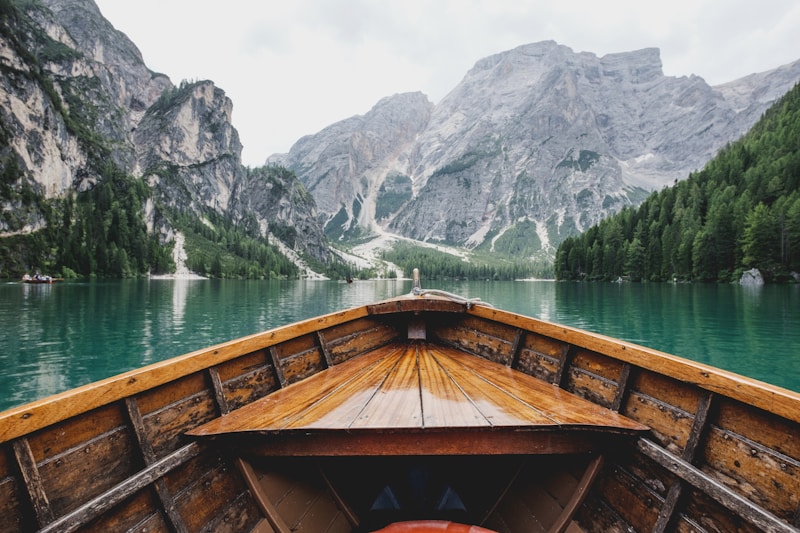
2,400 km² of rugged terrain, ranging from wind‑swept plains and dense lenga forests to glacial valleys and crystal‑clear lakes such as
Pehoé and
Grey. Visitors are drawn by the dramatic contrast of snow‑capped peaks against vivid blue‑green waters, a scenery that has inspired countless photographers, filmmakers, and adventure seekers.
The region’s climate is notoriously variable; strong westerly winds, sudden rain showers, and rapid temperature shifts are the norm, contributing to the park’s reputation as a place where nature’s raw power is on full display. Despite its harsh conditions, the area supports a surprisingly rich tapestry of life, including guanacos, Andean condors, and the elusive puma. The W Trek, a multi‑day circuit that threads through the park’s most celebrated vistas, has become a pilgrimage for trekkers worldwide, cementing Torres del Paine’s status as a premier destination for sustainable ecotourism.
History/Background
The name “Paine” derives from the indigenous
Tehuelche word for “blue,” a reference to the striking hue of the surrounding lakes and sky. Early European explorers, such as the Chilean naval officer
Alberto de Agostini, documented the region in the early 20th century, but it remained largely inaccessible until the 1940s, when a network of rough roads opened the area to sheep ranchers and modest tourism. In 1959, the Chilean government officially designated the area as
Torres del Paine National Park, initially covering only 1,200 km²; subsequent expansions in 1970 and 1990 brought the park to its current size. The 1970s also saw the rise of mountaineering expeditions, with the first successful ascent of the
South Tower (Cerro Paine Sur) recorded in 1961. Over the past five decades, conservation efforts have intensified, balancing visitor access with the protection of fragile ecosystems.
Key Information
-
Location: Magallanes Region, Chile; coordinates 51°00′S 73°00′W.
-
Area: Approximately
2,400 km² (925 sq mi).
-
Highest Peak: Cerro Paine Grande (2,884 m / 9,462 ft).
-
Main Attractions: The three granite towers (South, Central, and North),
Grey Glacier,
Lake Pehoé,
French Valley, and the
W Trek.
-
Flora & Fauna: Over 200 plant species, including the iconic
Nothofagus (Southern Beech) forests; mammals such as guanaco, puma, and the endangered
Andean deer; birds like the Andean condor and Magellanic woodpecker.
-
Visitor Statistics: Roughly
250,000 tourists per year, with the majority arriving between November and March (Southern Hemisphere summer).
-
Conservation Status: Part of the
Patagonia UNESCO World Heritage nomination; managed under Chile’s National Forest Corporation (CONAF) with strict limits on campsite numbers and trail usage.
-
Accessibility: Nearest gateway is the town of
Puerto Natales, 112 km away; the park is reachable via a paved road (Ruta 9) and a small regional airport.
Significance
Torres del Paine stands as a symbol of Patagonia’s untamed beauty and serves as a benchmark for global conservation practices. Its dramatic landscapes have propelled Chile onto the world stage as a premier destination for adventure tourism, generating significant economic benefits for local communities while fostering a deep appreciation for wilderness stewardship. The park’s inclusion in international dialogues on climate change underscores its role as a living laboratory; the retreat of the
Grey Glacier provides tangible evidence of warming trends, informing both scientific research and policy. Culturally, the towers have become an emblem of Chilean identity, appearing on postage stamps, travel literature, and even in contemporary art. By balancing human curiosity with ecological integrity, Torres del Paine illustrates how natural heritage can be both celebrated and protected for future generations.