Overview
From the mist-shrouded karst of Yucatán to the volcanic sierras of Guatemala, the Maya world comprised some 60 polities speaking 30+ mutually intelligible languages. Between 1000 BCE and 1500 CE these communities erected more than 150 stone cities, devised the only fully functional writing system in the pre-Columbian Americas, and calculated the solar year to 365.2420 days—more accurate than the Gregorian calendar then in use in Europe. Maya engineers built corbelled arches and 80-m-high temples without draft animals, the wheel, or metal tools, while their astronomers tracked Venus to within 2 hours of modern values. When Spanish friars arrived in the 16th century, they found not a vanished race but millions of farmers still using the 260-day tzolkʼin for planting maize and still venerating the same rain god, Chaac, whose masks glare from Classic temples.The civilization was never an empire. Instead, ajaw (holy lords) of dynastic houses such as the Snake Kings and the Copán dynasty negotiated alliances, trade monopolies, and marriage pacts that shifted power episodically. Hieroglyphic stairways record the accession of rulers in 184.108.40.206.0 (Long Count) dates, and polychrome vases depict royal women blood-letting with stingray spines to conjure visions of dynastic ancestors. Economic life revolved around cacao beans, obsidian blades, and cotton mantles carried by canoe along Caribbean and Gulf coasts; ideological life revolved on the cyclical resurrection of maize gods who promised kingship, fertility, and rebirth.
Background
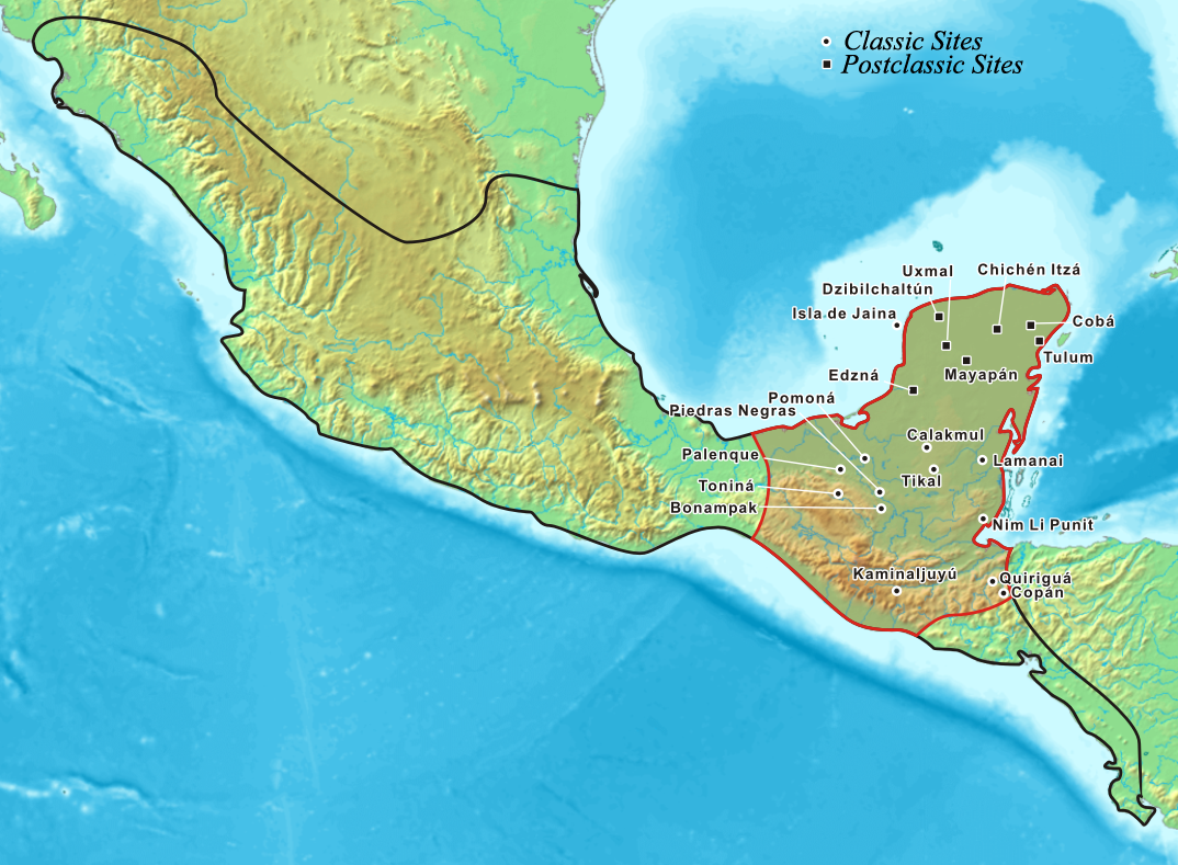
Paleo-Indians entered the lowlands c. 11,000 BCE, but the first villages with ceramics appear c. 1800 BCE along the Pacific littoral. By 900 BCE the Mokaya and Mixe-Zoquean neighbors were exchanging pottery styles that evolved into the Mamom and Chicanel ceramic spheres—the archaeological markers of what scholars call the Preclassic Maya. Monumental construction begins at Nakbé and El Mirador in the Mirador Basin; the latter grew to 200,000 inhabitants and the largest pyramid by volume in the Americas, La Danta. A Preclassic collapse (c. 100 CE) linked to volcanic ash and erosion opened space for the Classic fluorescence (250-900 CE) centered on Tikal, Calakmul, Palenque, and Copán. After the 9th-century “hiatus” marked by stelae cessation and palace burning, northern cities such as Chichén Itzá and, later, Mayapán dominated until internal revolts and Itza secession (1441) fragmented the lowlands. When Cortés passed through Acalan in 1525, he skirted a balkanized landscape that the Spaniards would not fully subdue until the 1697 fall of Nojpetén, the last independent capital.Key Facts
- 2600 BCE: Earliest maize pollen in Belize - 400 BCE: Earliest securely dated hieroglyphic text (San Bartolo murals) - 378 CE: “Entrance” of Siyaj K’ahk’ and the establishment of the Tikal dynasty - 692 CE: 220.127.116.11.0 k’atun ending celebrated from Copán to Palenque - 800-900 CE: Collapse of major southern cities; population drops >70 % - 1221 CE: Mayapán becomes dominant; League of Mayapán rules Yucatán - 1441 CE: Revolt of the Xiu lineage; Mayapán burned; era of petty kingdoms - 1517 CE: First Spanish sighting (Córdoba expedition) - 1542 CE: Spanish found Mérida on the ruins of T’ho - 1697 CE: Conquest of the Itzá capital, NojpeténWriting: ~1,000 glyphs (800 phonetic)
Calendar: 5,125-year Long Count cycle; zero date 3114 BCE
Mathematics: Base-20 with positional notation and shell zero
Astronomy: Lunar series predicting eclipses 6,000 years into the future
Population peak: c. 12 million (800 CE)
Cities: >150 mapped; 40,000 structures detected by LiDAR in northern Guatemala alone